Last Updated by Web-Dream on 2025-04-20
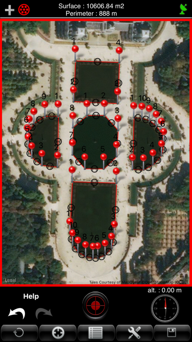
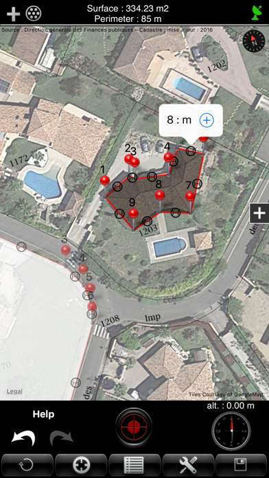
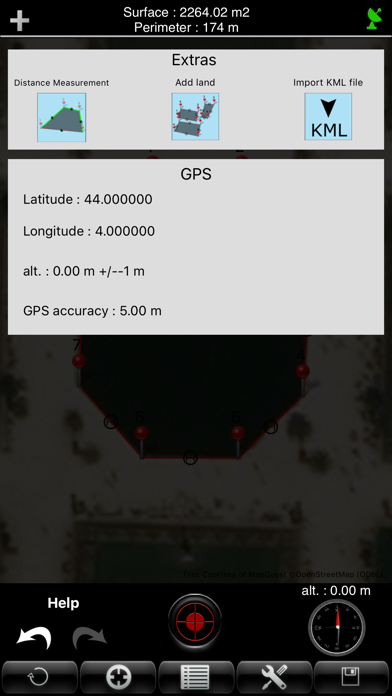
What is A2? A2 is a land measurement application that can measure and display the surface and perimeter of several lands on the same plan with intermediate distances. It can display the French land registry superimposed on the map, improving the measurement accuracy of the plots. A2 can save plans, edit them, and export them via e-mail with the format "KML" and "DXF". It has three ways of functioning: GPS, manual, and mixed. The calculation of the surface is effected and displayed at each input.
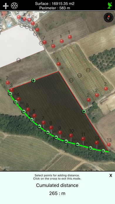
1. A2 can measure and display the surface and the perimeter of several land on the same plan with intermediate distances.The measurement can be displayed in feet, Inch, Yard or Feet.
2. - Mixed: the user is on the ground and seizes points via the GPS, then can add it manually (for difficult access for example).
3. A2 can save plans, edit them and export them via e-mail with the format "KML" (for use with software like Google Earth, Google Maps, Google Mobile, World Wind, Sketchup ...) and "DXF" (AutoCAD).
4. A2 is an application dedicated to the measurement of land area, perimeter and distance.
5. - The backup list shows the date, the area and perimeter of the ground saved.
6. To export a plan with the format 'KML', you must go to the backup list and press the icon 'email'.
7. You can insert a new point between two existing points to refine the tracing of the plan.
8. He then confirms a succession of points describing at best the ground thanks to the position supplied by the GPS.
9. - Unity of measure of the surface: m2 square feet, square yard, are, ha.
10. - Manual: the user seizes points manually without moving by finding a way on the map.
11. The application displays the French land registry superimposed on the map.
12. Liked A2? here are 5 Utilities apps like My Verizon; myAT&T; My Spectrum; Google; T-Mobile;
Or follow the guide below to use on PC:
Select Windows version:
Install A2 app on your Windows in 4 steps below:
Download a Compatible APK for PC
| Download | Developer | Rating | Current version |
|---|---|---|---|
| Get APK for PC → | Web-Dream | 1.00 | 5.2 |
Download on Android: Download Android
- Measurement of land area, perimeter, and distance
- Measurement can be displayed in feet, inch, yard, or meter
- French land registry superimposed on the map
- Save plans, edit them, and export them via e-mail with the format "KML" and "DXF"
- Import KML file
- Three ways of functioning: GPS, manual, and mixed
- Calculation of the surface is effected and displayed at each input
- Measurement of several surfaces on the same plane
- Measure of cumulative distance
- Viewing the perimeter and intermediate distances
- Viewing a compass and altitude for better geolocation
- Points information
- Movement of the seized points
- Deleting a point
- Manually inserting a new point between two existing points
- Display of the surface
- Archiving of the measures
- GPS reception indicator
- GPS information
- Export plans in the format 'KML'
- Backup list shows the date, the area, and perimeter of the ground saved
- Function "undo" and "redo" to undo or redo the last action performed
- Several options of measures are available: unit of measure, unity of measure of the surface, type of map, accuracy in GPS mode, and possibility to display the French Land registry with overlay on the map.
 PC Apps