Published by GeoPOI LLC on 2022-05-22
What is Outdoor Explorer Utah?
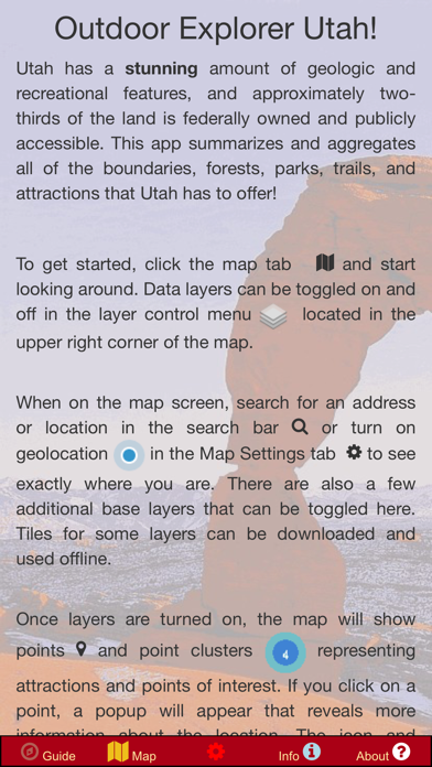
The Utah Public Lands app is a comprehensive resource for all public lands in Utah, including State Parks, National Parks, BLM Lands, and National Forests. It provides interactive maps with boundaries, trails, and data points for over 25,000 points of interest, including campgrounds, campsites, waterfalls, vistas, trailheads, hiking trails, tourist attractions, geologic points of interest, hot springs, meteorite recovery sites, boating access, and more. The app also includes GPS-based navigation, location/coordinate searches, and a variety of detailed basemaps, including road maps, topo maps, geologic maps, and aerial imagery. Relevant external links are included for reference, and the app can be used offline with several layers available for download.
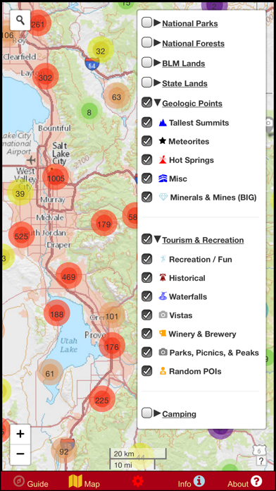
1. Some data sets include: Campgrounds, park offices, campsites, waterfalls, vistas, trailheads, hiking trails, tourist attractions, geologic points of interest, hot springs, meteorite recovery sites, boating access, and much more! Over 25,000 points are included, along with thousands of miles of trails and boundaries.
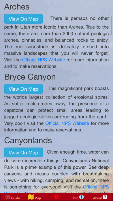
2. Relevant external links are included for reference and so that you can get the latest official information for a given park or forest without needing to search dozens of websites! Easily locate the major parks and forests and BLM land on the map with static programmed links that automatically pan and zoom the map to the area of interest.
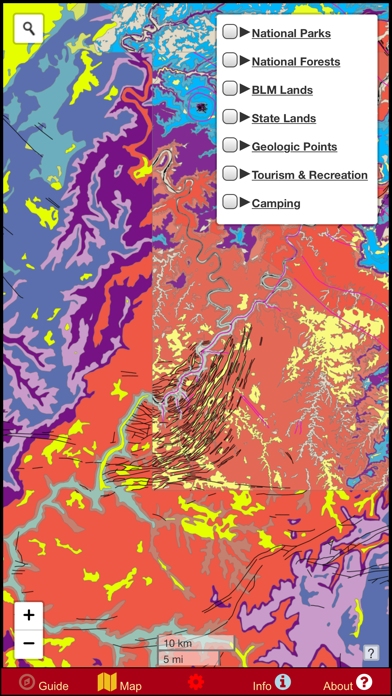
3. It includes boundaries, trails, and data points for State Parks, National Parks, BLM Lands, and National Forests, as well as a variety of other point-of-interest information.
4. A variety of detailed basemaps are provided: a road map, topo map, geologic map, aerial imagery, and more! Several layers have the capability to be downloaded for offline use so that you never have to worry about having reception or using cellular data in the remote wildernesses of Utah.
5. In addition to public data sets aggregated from around the internet, hundreds of independently mapped car campsites along roads in public lands are provided.
6. NOTE: A great deal of information is included in this app as offline data.
7. About two-thirds of Utah is owned by the US Government or the State government and can be enjoyed by everyone! The recreational opportunities range from boating and swimming to rock climbing, bicycling, and hiking.
8. Utah is a geologic wonderland with an incredible amount of canyons, trails, and public land.
9. The data is supplied as an elegant digital map that can easily be customized to show only the points that interest you.
10. This issue was left unresolved in order to offer the maximum amount of data feasible rather than the fastest performance.
11. Nobody else offers this much data aggregated into one convenient offline app.
12. Liked Outdoor Explorer Utah? here are 5 Navigation apps like GSVExplorer for Google Maps™; Nearby Explorer Online; ShippingExplorer; Hema Explorer North America; NUS Campus Explorer;
Or follow the guide below to use on PC:
Select Windows version:
Install Outdoor Explorer Utah - Map app on your Windows in 4 steps below:
Download a Compatible APK for PC
| Download | Developer | Rating | Current version |
|---|---|---|---|
| Get APK for PC → | GeoPOI LLC | 1 | 1.2.0 |
Get Outdoor Explorer Utah on Apple macOS
| Download | Developer | Reviews | Rating |
|---|---|---|---|
| Get $2.99 on Mac | GeoPOI LLC | 0 | 1 |
Download on Android: Download Android
- Interactive maps with boundaries, trails, and data points for State Parks, National Parks, BLM Lands, and National Forests
- Over 25,000 points of interest, including campgrounds, campsites, waterfalls, vistas, trailheads, hiking trails, tourist attractions, geologic points of interest, hot springs, meteorite recovery sites, boating access, and more
- Hundreds of independently mapped car campsites along roads in public lands
- GPS-based navigation and location/coordinate searches
- Detailed basemaps, including road maps, topo maps, geologic maps, and aerial imagery
- Several layers available for download for offline use
- Relevant external links for reference
- Can be used offline
- Proprietary data set for finding free camping in federal land
- Static programmed links that automatically pan and zoom the map to the area of interest
- Created by GeoPOI LLC, a small, individually owned cartography business founded in Saint Paul, Minnesota.
 PC Apps