Last Updated by Bist LLC on 2025-05-28

1. This App offers offline nautical charts, lake & river navigation maps covering Netherlands/Holland (derived from NLHO data) for fishing, kayaking, boating and sailing.
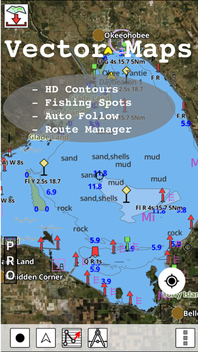
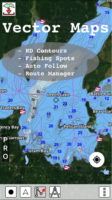
2. Coverage includes marine vector charts, freshwater lake maps, and inland river maps (HD/1ft/3ft bathymetry included where available).
3. First marine GPS app to have route assistance with Voice Prompts for marine navigation.
4. √ 1ft / 3ft depth contour maps for anglers for selected lake maps.
5. √ Query details of Marine object (Buoy, Lights, Obstruction etc).
6. You can create new boating routes or import existing GPX/KML routes.
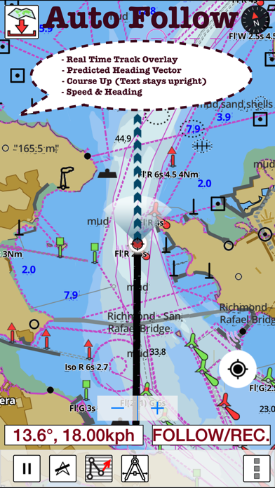
7. √ Record tracks, Autofollow with real-time track overlay & predicted path vector.
8. √ Supports GPX/KML for boating route editing/import.
9. It supports Nautical Charts course up orientation.
10. Netherlands:Marine ENC & Inland ENC (derived from NLHO data).
11. Includes Tide & Currents prediction.
12. Liked i-Boating? here are 5 Navigation apps like Boating US West & Alaska GPS chart navigator; Boating USA GPS Nautical Chart; Boating Miami to Key West GPS; Boating Florida Nautical Chart; Boating Hawaii GPS kml map nautical fishing charts;
Or follow the guide below to use on PC:
Select Windows version:
Install i-Boating:Holland/Netherlands app on your Windows in 4 steps below:
Download a Compatible APK for PC
| Download | Developer | Rating | Current version |
|---|---|---|---|
| Get APK for PC → | Bist LLC | 1 | 83.0.0 |
Download on Android: Download Android
 PC Apps