Last Updated by Christopher Coudriet on 2025-03-11
What is NOAA Weather Center?
Weather Center is a professional weather application that provides accurate and timely weather data directly from NOAA's weather sources. It offers a wide range of features, including storm tracking, tropical storm and hurricane tracking, severe weather tracking, interactive maps, and general weather information.
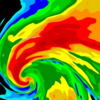
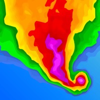
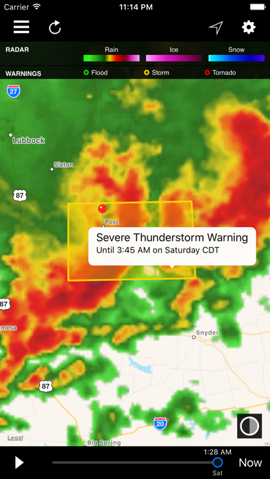
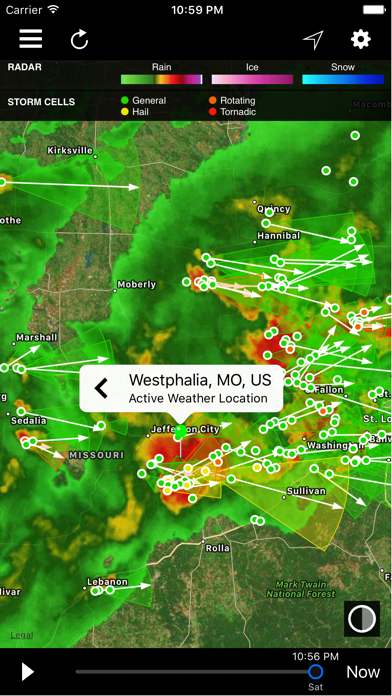
1. Want to track Tropical Storms & Hurricanes? With Weather Center you can like no other app! You can view our exclusive high resolution satellite imagery and choose from 3 different satellites Satellite, Visible Satellite and Global Satellite! In addition you can view our high resolution radar for storms affecting the coastline! All this on a user friendly and familiar map you've come to know already.
2. Weather Center is a professional application with professional features not found in your average weather app.
3. In addition radar and most map overlays are currently only supported over the continental USA, Alaska, Hawaii and Puerto Rico.
4. Disclaimer: Not recommend for non US locations.
5. Liked NOAA Weather Center? here are 5 Weather apps like Weather - The Weather Channel; WeatherBug – Weather Forecast; AccuWeather: Weather Forecast; Weather; MyRadar Weather Radar;
GET Compatible PC App
| App | Download | Rating | Maker |
|---|---|---|---|
 NOAA Weather Center NOAA Weather Center |
Get App ↲ | 145 4.21 |
Christopher Coudriet |
Or follow the guide below to use on PC:
Select Windows version:
Install NOAA Weather Center app on your Windows in 4 steps below:
Download a Compatible APK for PC
| Download | Developer | Rating | Current version |
|---|---|---|---|
| Get APK for PC → | Christopher Coudriet | 4.21 | 5.3 |
Get NOAA Weather Center on Apple macOS
| Download | Developer | Reviews | Rating |
|---|---|---|---|
| Get $1.99 on Mac | Christopher Coudriet | 145 | 4.21 |
Download on Android: Download Android
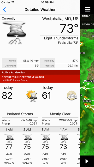
- Accurate and timely weather data from NOAA's weather sources
- Storm tracking with real storm reports from storm spotters in the field
- Tropical storm and hurricane tracking with high-resolution satellite imagery and radar
- Severe weather tracking with detailed precision and nearby storm reports
- Active advisories from the NWS with detailed descriptions
- Interactive map with 6 animated overlay options and 8 non-animated options
- Point data for storm cells, storm reports, climate records, earthquakes, and wildfires
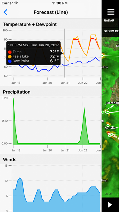
- Detailed weather forecasts, NWS watches, warnings, and advisories, hourly forecasts, weekend-only forecasts, 7-day forecasts, and 14-day forecasts
- Sun and moon information, moon phases, climate normals, and current tides
- Disclaimer: Not recommended for non-US locations. Radar and most map overlays are currently only supported over the continental USA, Alaska, Hawaii, and Puerto Rico.
- Offers a vast array of weather information
- Maps seem to be the most accurate when tracking storms
- Provides area-specific information by clicking on icons on the map
- Allows customization of weather information with specific map overlays
- Has a Watches and Warnings tab for push alerts
- Radar feature is invaluable for travelers
- Provides information on weather in destinations frequented by the user
- Can be a little complicated and difficult to use initially
Long running app
Finally a weather that is dependable
Great tool
A Weather Center in the palm of your hand!
 PC Apps