Last Updated by Bist LLC on 2025-07-01
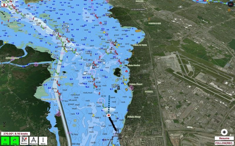

1. Coverage includes NOAA marine vector charts,freshwater lake maps,USACE inland river maps (HD/1ft/3ft bathymetryincluded where available),charts derived from UKHO & CHS data.
2. √USA: The maps include coverage of all NOAA marine vector charts (ENC),USACE inland river maps,freshwater lake maps for more than 7K lakes.
3. The charts include HD/1ft/3ft bathymetry where available.Incl. NOAA raster where ENC not available.
4. This App offers access to Marine Charts for USA and Canada.
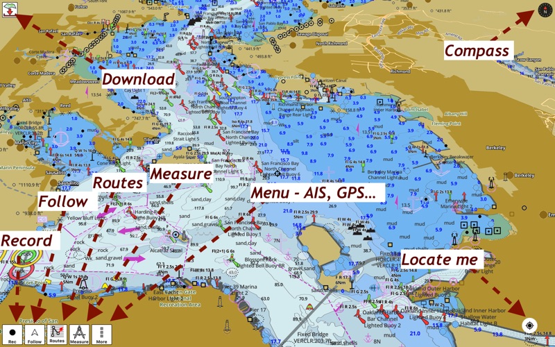
5. √ Long press to query the details of Marine object (Buoy,Lights,Obstruction etc).
6. √ 1ft / 3ft depth contour maps for anglers for selected lake maps.
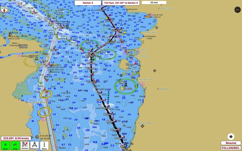
7. First marine GPS app to have route assistance for marine navigation.
8. It supports Nautical Charts course up orientation.
9. √ Record tracks,Autofollow with real-time track overlay & predicted path vector.
10. You can create new boating routes or import existing GPX/KML routes.
11. √ Supports GPX/KML for boating route editing/import.
12. Liked i-Boating? here are 5 Travel apps like i-Boating:Caribbean Marine/Nautical Charts & Maps; Texas Boating Ramps; Lake Tahoe – Boating Maps; Virginia Boating; Asia-Pacific Boating;
Or follow the guide below to use on PC:
Select Windows version:
Install i-Boating:CAN+US Marine Charts app on your Windows in 4 steps below:
Download a Compatible APK for PC
| Download | Developer | Rating | Current version |
|---|---|---|---|
| Get APK for PC → | Bist LLC | 1 | 93.0.0 |
Download on Android: Download Android
 PC Apps