Last Updated by Bist LLC on 2025-07-14

1. This App offers access to marine vector covering German waters (derived from BSH data).
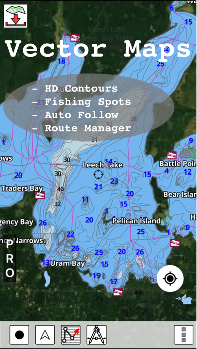
2. The maps include coverage of Germany (both coastal and inland waters) (derived from BSH data).
3. √ Long press to query the details of Marine object (Buoy, Lights, Obstruction etc).
4. First marine GPS app to have route assistance with Voice Prompts for marine navigation.
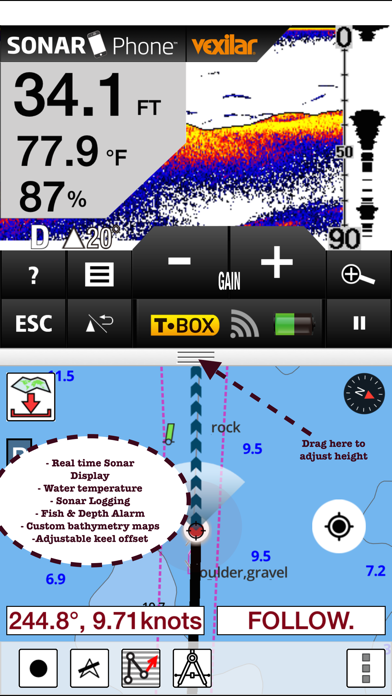
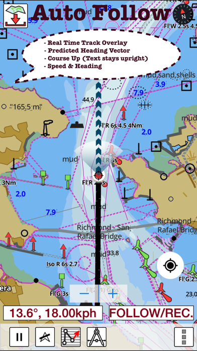
5. √ Record tracks, Autofollow with real-time track overlay & predicted path vector.
6. You can create new boating routes or import existing GPX/KML routes.
7. √ Supports GPX/KML for boating route editing/import.
8. √ 1ft / 3ft depth contour maps for anglers for selected lake maps.
9. It supports Nautical Charts course up orientation.
10. Includes Tide & Currents prediction.
11. * Export tracks/routes/markers as compressed GPX files.
12. Liked i-Boating? here are 5 Travel apps like Asia-Pacific Boating; i-Boating:Caribbean Marine/Nautical Charts & Maps; Chesapeake Boating; Texas Boating Ramps; Colorado Boating;
Or follow the guide below to use on PC:
Select Windows version:
Install i-Boating:Germany Marine Chart app on your Windows in 4 steps below:
Download a Compatible APK for PC
| Download | Developer | Rating | Current version |
|---|---|---|---|
| Get APK for PC → | Bist LLC | 1 | 114.0.0 |
Download on Android: Download Android
 PC Apps