Last Updated by Bist LLC on 2024-07-11
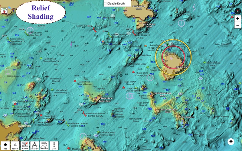
1. Coverage includes NOAA marine vector charts,freshwater lake maps,USACE inland river maps (HD/1ft/3ft bathymetry included where available),charts derived from UKHO & CHS data.
2. √USA: The maps include coverage of all NOAA marine vector charts (ENC),USACE inland river maps,freshwater lake maps for more than 7K lakes.
3. The charts include HD/1ft/3ft bathymetry where available.Incl. NOAA raster where ENC not available.
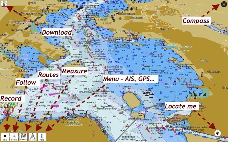
4. √ Long press to query the details of Marine object (Buoy,Lights,Obstruction etc).
5. √ 1ft / 3ft depth contour maps for anglers for selected lake maps.
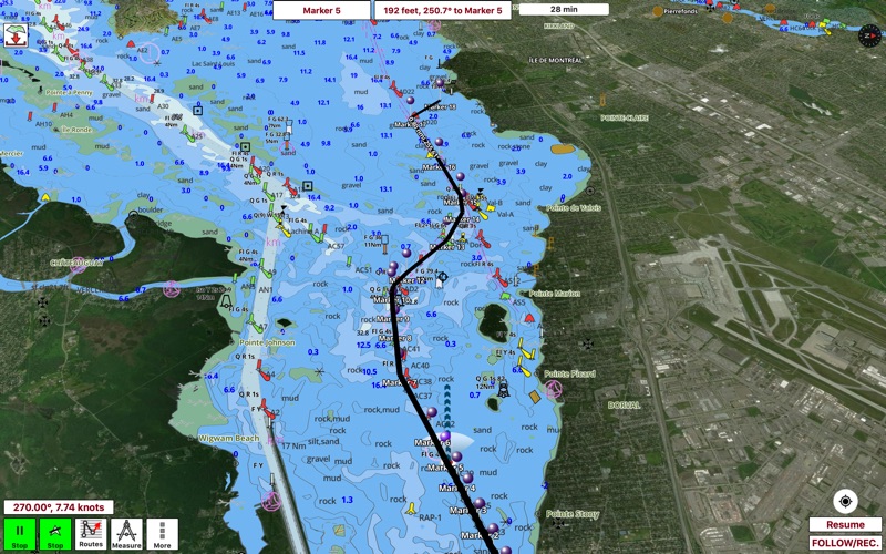
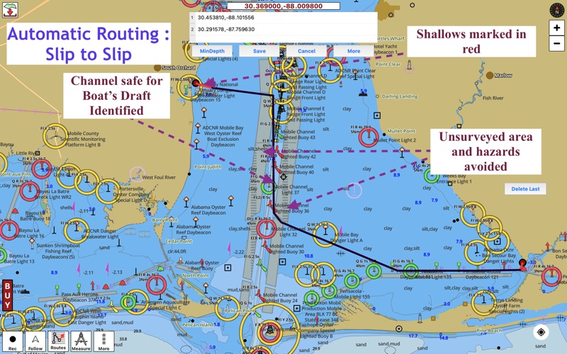
6. First marine GPS app to have route assistance for marine navigation.
7. √ Record tracks,Autofollow with real-time track overlay & predicted path vector.
8. It supports Nautical Charts course up orientation.
9. You can create new boating routes or import existing GPX/KML routes.
10. √ Supports GPX/KML for boating route editing/import.
11. √ Marine Ais & (NMEA AIS and GPS over TCP/UDP).
12. Liked i-Boating? here are 5 Travel apps like i-Boating:Caribbean Marine/Nautical Charts & Maps; Texas Boating Ramps; Lake Tahoe – Boating Maps; Virginia Boating; Asia-Pacific Boating;
Or follow the guide below to use on PC:
Select Windows version:
Install i-Boating : Marine Navigation app on your Windows in 4 steps below:
Download a Compatible APK for PC
| Download | Developer | Rating | Current version |
|---|---|---|---|
| Get APK for PC → | Bist LLC | 1 | 146.0.0 |
Download on Android: Download Android
 PC Apps