Last Updated by Harald Meyer on 2025-04-25
What is Cartograph Map Viewer?
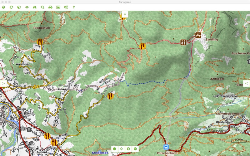
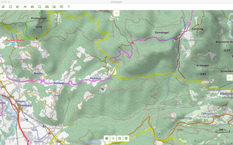
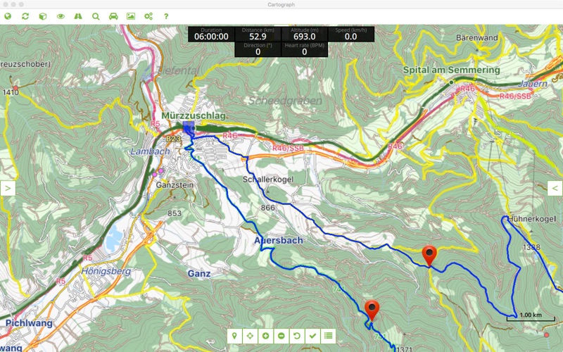
The Cartograph app is a mapping application that allows users to view offline and online maps, track their location, and edit and record tracks. It supports various map formats, including Mapsforge, MBTiles, and rmap, and allows users to customize their trip computer and view a 3D snapshot of their current location. The app also supports live tracking and polling, as well as the ability to add text and photo waypoints.
1. The Cartograph app views offline and online maps, supports track recording, editing, and live tracking.
2. - Support for Mapsforge (0.7) offline vector maps and Mapsforge themes (V6, including customized style layering).
3. - View offline and online maps (slippy tiles and WMS/Web Map Services based on WG84/EPSG-4326/900913).
4. The app also supports the popular Mapsforge format, as well as SQLite based raster maps such as mbtiles and rmap (Locus).
5. - Live tracking: send your current location to a custom webserver* via HTTP GET or GPSies service.
6. - Support for offline overlays (drinking water sources, restaurants, supermarkets, hostels, custom overlays).
7. - Experimental (!) support for offline hill shading based on Nasa SRTM elevation data.
8. - Live polling: poll other users' location from a custom webserver* via HTTP GET and show it in the map.
9. - Mapsforge multi-maps (combine multiple maps into a single one, e.g. around country borders).
10. - Support for 2nd map layer which can be used for overlay maps (e.g. OpenSeaMap), hillshading, etc.
11. - GPS webserver source allows you to send GPS location via HTTP to Cartograph.
12. Liked Cartograph Map Viewer? here are 5 Travel apps like Cartograph Maps 2; Lyft; Uber - Request a ride; United Airlines; Southwest Airlines;
Or follow the guide below to use on PC:
Select Windows version:
Install Cartograph Map Viewer app on your Windows in 4 steps below:
Download a Compatible APK for PC
| Download | Developer | Rating | Current version |
|---|---|---|---|
| Get APK for PC → | Harald Meyer | 1 | 1.022 |
Get Cartograph Map Viewer on Apple macOS
| Download | Developer | Reviews | Rating |
|---|---|---|---|
| Get $14.99 on Mac | Harald Meyer | 0 | 1 |
Download on Android: Download Android
- View offline and online maps (slippy tiles and WMS/Web Map Services based on WG84/EPSG-4326/900913).
- Support for Mapsforge (0.7) offline vector maps and Mapsforge themes (V6, including customized style layering).
- MBTiles, and rmap (Locus) offline raster maps.
- Mapsforge multi-maps (combine multiple maps into a single one, e.g. around country borders).
- GPS tracking (including USB-to-serial and Bluetooth-to-serial GPS mice).
- GPS webserver source allows you to send GPS location via HTTP to Cartograph.
- Support for Bluetooth 4 BLE heart frequency and cadence devices (for instance Polar H7 belt). This feature requires compatible hardware.
- Customizable trip computer.
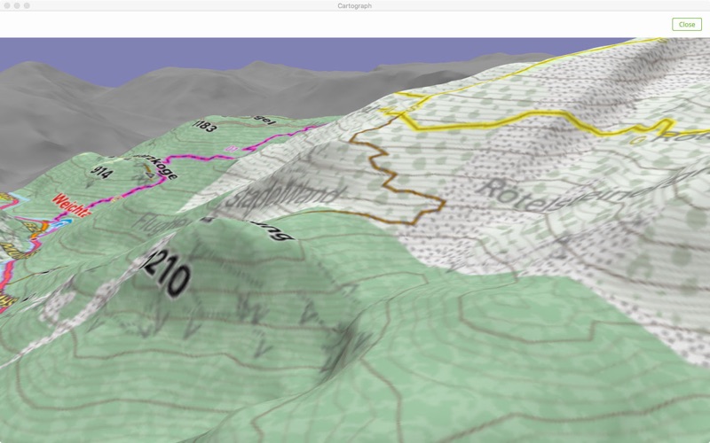
- A 3D view gives a 3D snapshot of the current location.
- Support for 2nd map layer which can be used for overlay maps (e.g. OpenSeaMap), hillshading, etc.
- Experimental (!) support for offline hill shading based on Nasa SRTM elevation data.
- Online route and address search.
- Support for offline overlays (drinking water sources, restaurants, supermarkets, hostels, custom overlays).
- Support for metric, imperial, and nautic units.
- Text-, and photo waypoints.
- Basic track drawing and editing feature.
- Show multiple tracks at the same time.
- Live tracking: send your current location to a custom webserver* via HTTP GET or GPSies service.
- Live polling: poll other users' location from a custom webserver* via HTTP GET and show it in the map.
- Simple chart, statistics, distance measurements.
- *The webserver implementation is not part of the Cartograph app!
 PC Apps