Last Updated by The Other Hat on 2025-06-13
1. This app is based on the United Kingdom Hydrographic Office's print publication "Chart 5011 (INT 1) EDITION 2" Admiralty Charts Publication and "Chart No.1 United States of America Nautical Chart Symbols, Abbreviations and Terms".
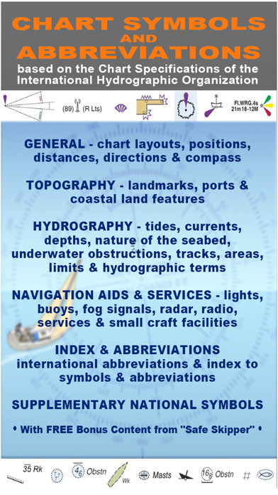
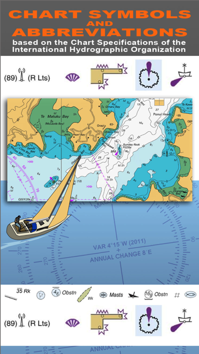
2. "CHART SYMBOLS & ABBREVIATIONS" provides quick reference to the "INT 1" symbols specified by the International Hydrographic Organization (IHO) for use on International marine charts.
3. SYMBOLS USED ON NAUTICAL CHARTS SPECIFIED BY THE INTERNATIONAL HYDROGRAPHIC ORGANIZATION (IHO), PLUS INTERNATIONAL ABBREVIATIONS AND SUPPLEMENTARY NATIONAL SYMBOLS USED BY THE U.S. AND U.K. HYDROGRAPHIC OFFICES.
4. SUPPLEMENTARY NATIONAL SYMBOLS Supplementary National Symbols for nautical charts used by the United States and United Kingdom are included at the end of each section.
5. NOTE: ECDIS symbols used to display Electronic Navigational Chart (ENC) data on Electronic Chart Display and Information Systems (ECDIS) as specified by the IHO are not included on this app.
6. A bonus section has tips on how to deal with emergencies including: Abandon ship; Dismasting; Distress Signals; Engine Failure; Fire Fighting; Flares; Getting a tow; Helicopter rescue; Holed hull; Man overboard; Medical emergency; Mayday; Panpan; Securité.
7. INDEX The index is an A-Z of symbols and abbreviations and enables the user to quickly look up the symbols and see them in context with others in the same categories.
8. INDEX & ABBREVIATIONS - international abbreviations and index to symbols and abbreviations.
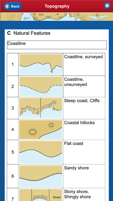
9. There are five main sections in this app, each with lettered sub-sections organized into categories to guide users through the hundreds of symbols.
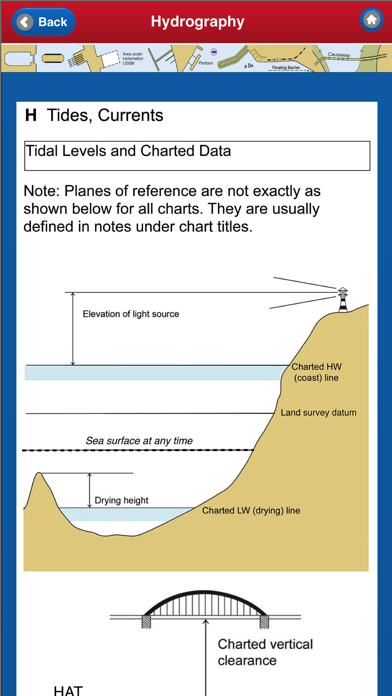
10. HYDROGRAPHY - tides, currents, depths, nature of the seabed, underwater obstructions, tracks, areas, limits and hydrographic terms.
11. We have an on-going program of marine navigation and boating safety apps, so please contact us with any ideas or features that you would like to see included.
12. Liked NAUTICAL CHART SYMBOLS & ABBREVIATIONS? here are 5 Navigation apps like Lake Winnipesaukee offline chart for boaters; Boating Florida Nautical Chart; Lake Norman GPS Nautical Chart; Japan Chart Navi; Florida GPS Nautical Chart Pro;
GET Compatible PC App
| App | Download | Rating | Maker |
|---|---|---|---|
 NAUTICAL CHART SYMBOLS & ABBREVIATIONS NAUTICAL CHART SYMBOLS & ABBREVIATIONS |
Get App ↲ | 2 3.50 |
The Other Hat |
Or follow the guide below to use on PC:
Select Windows version:
Install NAUTICAL CHART SYMBOLS & ABBREVIATIONS app on your Windows in 4 steps below:
Download a Compatible APK for PC
| Download | Developer | Rating | Current version |
|---|---|---|---|
| Get APK for PC → | The Other Hat | 3.50 | 3.0 |
Get NAUTICAL CHART SYMBOLS & ABBREVIATIONS on Apple macOS
| Download | Developer | Reviews | Rating |
|---|---|---|---|
| Get $1.99 on Mac | The Other Hat | 2 | 3.50 |
Download on Android: Download Android
Good for learning & quick reference
 PC Apps