Last Updated by seawellsoft on 2025-04-07

What is Marine ALASKA SW Offline chart?
Seawell marine navigation application is designed for sailors, fishermen, divers, boaters, and cruisers. It offers comprehensive coverage with good chart view management, track recording, and safety features like MOB. The app provides maps to make life easier and more enjoyable for marine enthusiasts.
1. *** For people who are looking for appealing charts, features like seamless scrolling, comprehensive coverage with good chart view management, track recording and safety feature (MOB), Seawell marine navigation applications are the best choice.
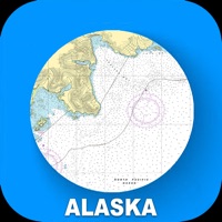
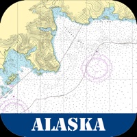
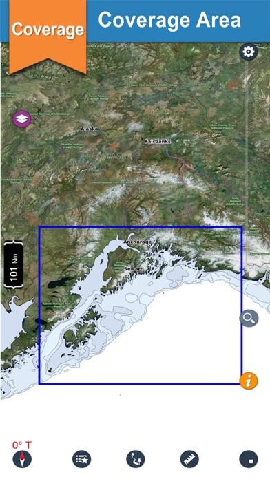
2. Coverage of the chart is extensive and detailed: Alaska South West-Our chart covers Anchorage, Seward, Iliamna Lake, Kukaklek Lake, Nonvianuk Lake, Chenik Head, Augustine Volcano, West Foreland, Boulder Point, Moose Point, Lake Spenard, Polar Race way Park, Elks Lake and many more.
3. Lots of care has been taken to avoid clutter of icons, to utilize the full view of the chart to display only the map.
4. √ Intuitive track detail view helps you to start / stop / pause / continue your track recording.
5. Three modes of GPS tracking, Red denotes user location centered and north up, yellow denotes user location is tracked but not centered with north up and blue denotes user location centered and map is rotated in course UP direction.
6. With Seawell chart application you can zoom in and out without having to look for and load different charts.
7. With a single ON/OFF button, you can have full chart clear view.
8. You can still scroll/zoom even when the favorites list or track list view is open.
9. You can also mark or add favorite spots, dynamically without going back and forth to the chart.
10. √ You can simply use your finger to tap positions on the chart where you want favorites.
11. √ Intuitive interface to turn a track ON/ OFF, edit details & delete.
12. Liked Marine ALASKA SW Offline chart? here are 5 Navigation apps like Scenic Map Alaska; Marine Alaska S. E. GPS Charts; Alaska, USA Offline Navigation; Alaska Marine Charts RNC; Boating US West & Alaska GPS chart navigator;
GET Compatible PC App
| App | Download | Rating | Maker |
|---|---|---|---|
 Marine ALASKA SW Offline chart Marine ALASKA SW Offline chart |
Get App ↲ | 3 1.00 |
seawellsoft |
Or follow the guide below to use on PC:
Select Windows version:
Install Marine ALASKA SW Offline chart app on your Windows in 4 steps below:
Download a Compatible APK for PC
| Download | Developer | Rating | Current version |
|---|---|---|---|
| Get APK for PC → | seawellsoft | 1.00 | 3.1 |
Get Marine ALASKA SW Offline chart on Apple macOS
| Download | Developer | Reviews | Rating |
|---|---|---|---|
| Get $6.99 on Mac | seawellsoft | 3 | 1.00 |
Download on Android: Download Android
- Comprehensive coverage of the chart, including Alaska South West
- Seamless scrolling and zooming without having to load different charts
- Clear chart view management with configurable buttons
- Track recording with an intuitive interface to turn on/off, edit details, and delete
- GPS tracking with three modes: north up, course up, and user location tracked but not centered
- Favorites list with easy-to-use interface and the ability to add images and share with friends and family
- Distance measure for measuring distances from the boat
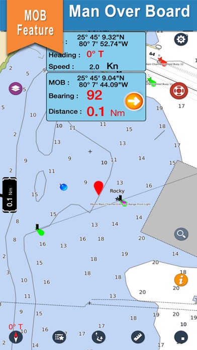
- MOB function to show the way back to MOB and share position with emergency services
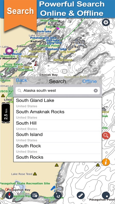
- Online and offline search
- Speed of boat measurement
- Multiple overlays: offline, hybrid, topo, and street mode
- Note: continued use of GPS running in the background can decrease battery life, so turn off GPS when not in use.
 PC Apps