Published by 3D RealityMaps GmbH on 2022-04-21
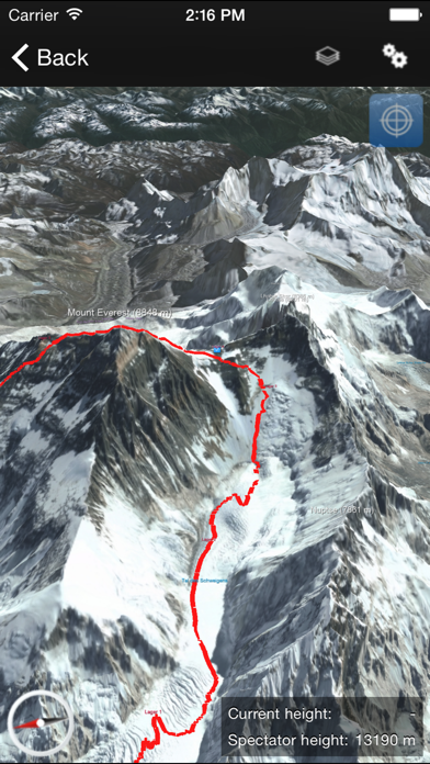
1. Follow the trail from Lukla to Mount Everest base camp and ascent the roof of the world via the Khumbu Icefall and the Lhotse flank.
2. The ProVersion provides detailed information about famous treks and mountain peaks in the Khumbu National Park including the tracks to Gokyo Ri (5,360 m) and Iceland Peak (6,173 m).
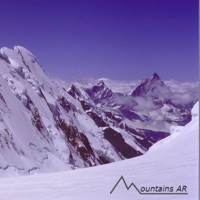
3. Mount Everest 3D shows the highest mountain of the world in a unique resolution on a smartphone or tablet.
4. Use the ProVersion if you plan a trekking tour to Mount Everest base camp.
5. Take a look at Mount Everest from any angle and navigate through the area with simple touch gestures.
6. This version allows you to highlight your own position in the 3D map using the built-in GPS, to record your tracks and to store the daily statistics.
7. In order to use the 3D map on site without cellular connection, the map data can be downloaded and stored directly on the smartphone.
8. The world-famous trek is described day by day in every detail and illustrated with pictures.
9. For this 3D map high-resolution images of the WorldView-2 satellites have been used.
10. Remark: Continued use of the GPS can dramatically decrease battery life.
11. Liked Mount Everest 3D? here are 5 Navigation apps like Rocky Mountain National Park - GPS Map Navigator; Altimeter Mountain GPS Tracker; Great Smoky Mountains Park - GPS Map Navigator; Mountains AR;
GET Compatible PC App
| App | Download | Rating | Maker |
|---|---|---|---|
 Mount Everest 3D Mount Everest 3D |
Get App ↲ | 38 4.37 |
3D RealityMaps GmbH |
Or follow the guide below to use on PC:
Select Windows version:
Install Mount Everest 3D app on your Windows in 4 steps below:
Download a Compatible APK for PC
| Download | Developer | Rating | Current version |
|---|---|---|---|
| Get APK for PC → | 3D RealityMaps GmbH | 4.37 | 1.9.220421 |
Get Mount Everest 3D on Apple macOS
| Download | Developer | Reviews | Rating |
|---|---|---|---|
| Get Free on Mac | 3D RealityMaps GmbH | 38 | 4.37 |
Download on Android: Download Android
Horrible game
Buggy, slow & badly designed
Worthy!! Just info alone...
Just use google earth.
 PC Apps