Last Updated by Navtech Software on 2024-08-27


What is iStreams West Scotland?
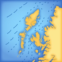
iStreams is a smart app that displays the valid hourly West Scotland tidal stream atlas for the current real-time, in reference to the time of high water at Dover. The app is fully functional offline and comes with tools to measure tide set and interpolated rate. The app automatically selects the nearest Dover HW time of the day, but users can swipe forward or back to advance the tidal hour. Users can also tap on the date to select a different date for forward planning.
1. The nearest Dover HW time to the actual time is selected from the database and the relevant streams chart is displayed, together with the time period for which the chart is valid.
2. iStreams displays the valid hourly West Scotland tidal stream atlas for the current real time, in reference to the time of high water at Dover... a smart app, fully functional offline.
3. As the time moves to the next valid period, the relevant hourly chart is auto displayed.
4. * Whenever the chart displayed is valid at the current time, the validity period is displayed in green.
5. The app automatically selects the nearest Dover HW time of the day, but if you want to see data for the next or previous HW of the day, swipe forward or back to advance the tidal hour.
6. Select the rate tool to auto calculate the interpolated tidal rate when in between neaps and springs.
7. * Swiping on the chart (or using navigation buttons), displays the next or previous tidal hour chart.
8. Select the 'Set' tool to measure the precise true course of any tidal stream arrow.
9. For forward planning, tap on the date to select a different date, whereupon data relevant to that date will be displayed.
10. * Tapping the location button shows your actual boat position on the chart.
11. Select the 'CTS' tool to calculate a Course to Steer.
12. Liked iStreams West Scotland? here are 5 Navigation apps like Boating US West & Alaska GPS chart navigator; Boating Miami to Key West GPS; Scenic Map Western USA; VeloDispo Western Europe; BringGo Western Europe;
GET Compatible PC App
| App | Download | Rating | Maker |
|---|---|---|---|
 iStreams West Scotland iStreams West Scotland |
Get App ↲ | 0 1 |
Navtech Software |
Or follow the guide below to use on PC:
Select Windows version:
Install iStreams West Scotland app on your Windows in 4 steps below:
Download a Compatible APK for PC
| Download | Developer | Rating | Current version |
|---|---|---|---|
| Get APK for PC → | Navtech Software | 1 | 2.91 |
Get iStreams West Scotland on Apple macOS
| Download | Developer | Reviews | Rating |
|---|---|---|---|
| Get Free on Mac | Navtech Software | 0 | 1 |
Download on Android: Download Android
- Displays valid hourly West Scotland tidal stream atlas for the current real-time
- Fully functional offline
- Tools to measure tide set and interpolated rate
- Automatically selects the nearest Dover HW time of the day
- Swiping on the chart (or using navigation buttons) displays the next or previous tidal hour chart
- Displays validity period in green when the chart displayed is valid at the current time
- Pinching the screen zooms the chart
- Tapping the location button shows actual boat position on the chart
- Select Local or UTC time
- Select the rate tool to auto calculate the interpolated tidal rate when in between neaps and springs
- Select the 'Set' tool to measure the precise true course of any tidal stream arrow (in-app purchase)
- Select the 'CTS' tool to calculate a Course to Steer (in-app purchase)
- Users can swipe forward or back to advance the tidal hour for forward planning
- Tap on the date to select a different date for forward planning.
 PC Apps