Last Updated by CritterMap Software on 2025-01-29
1. A worldwide vector map, known as the BackCountry World Map, allows for quick download of large blocks.
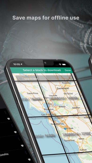
2. An easy grid interface lets you choose blocks for download, and see those you have already downloaded.
3. Optional overlays enhance map with boundaries, parcel data, or trail maps.
4. Choose and download maps for offline use.
5. BLM boundaries show limits of various types of federal lands within the western United States.
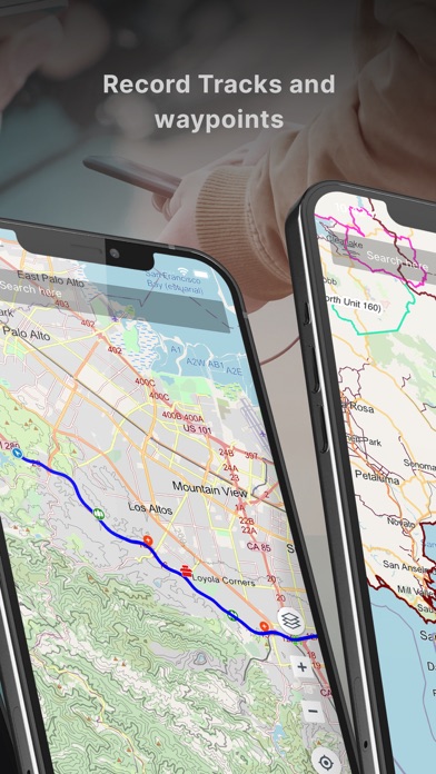
6. Switch to offline maps to see what you have downloaded when out in the backcountry.
7. Most US States have parcel data and wildlife management boundaries.
8. Some countries with specific content to consider are Spain, UK, Australia, New Zealand, and Canada.
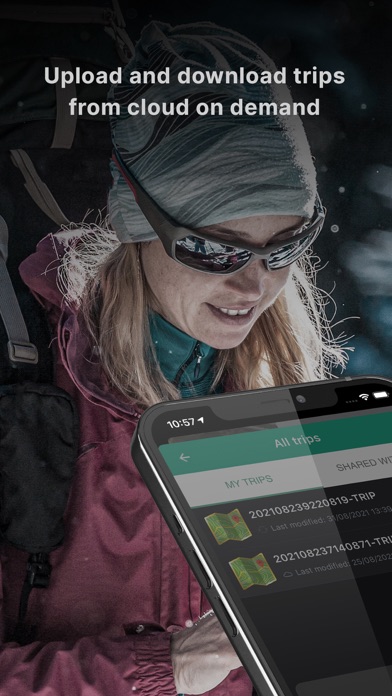
9. Upload or download trips from the cloud on demand.
10. With membership, save maps for offline use.
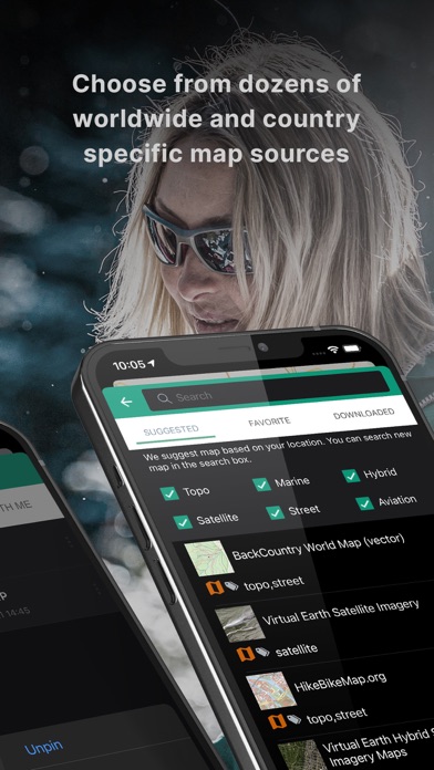
11. Choose from over 50 worldwide and country specific map sources.
12. Liked BackCountry Navigator XE? here are 5 Navigation apps like Yandex Maps & Navigator; ÖPNV Navigator; MapFactor Navigator - GPS Maps; VZ Navigator; NaviGator for Gainesville RTS;
GET Compatible PC App
| App | Download | Rating | Maker |
|---|---|---|---|
 BackCountry Navigator XE BackCountry Navigator XE |
Get App ↲ | 36 2.81 |
CritterMap Software |
Or follow the guide below to use on PC:
Select Windows version:
Install BackCountry Navigator XE app on your Windows in 4 steps below:
Download a Compatible APK for PC
| Download | Developer | Rating | Current version |
|---|---|---|---|
| Get APK for PC → | CritterMap Software | 2.81 | 0.6.57 |
Get BackCountry Navigator XE on Apple macOS
| Download | Developer | Reviews | Rating |
|---|---|---|---|
| Get Free on Mac | CritterMap Software | 36 | 2.81 |
Download on Android: Download Android
 PC Apps