Last Updated by seawellsoft on 2025-04-16

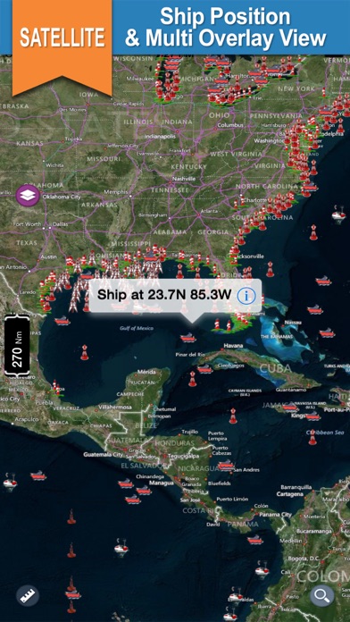
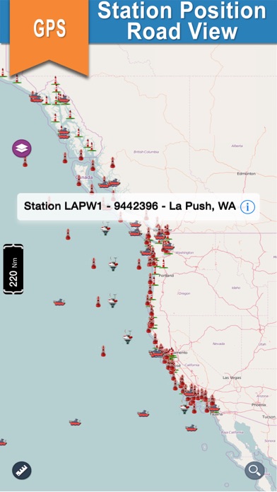
1. Sailors & Mariners can find the nearest buoy station &ships showing station name, ship name, date, time along with their respective icons.
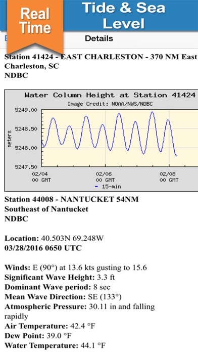
2. Shows the ship location in real time and providesinformation about buoys, lighthouses, oilrigs, Tsunami indicators, T.A.O on the world map.
3. All buoy stations &shipsare displayed on the world map based on the user’s current location while boating.
4. NOAA Buoy is the preferred resource for boating, sailing, diving and fishing.
5. Liked NOAA Buoy? here are 5 Weather apps like NOAA Buoy Reports; Seaside Buoy; Buoy Finder NOAA NDBC; NOAA National Data Buoy Marine; NOAA Buoy and Tide Data;
Or follow the guide below to use on PC:
Select Windows version:
Install NOAA Buoy - Real Time Data on Stations & Ships app on your Windows in 4 steps below:
Download a Compatible APK for PC
| Download | Developer | Rating | Current version |
|---|---|---|---|
| Get APK for PC → | seawellsoft | 1.00 | 1.3 |
Download on Android: Download Android
Bad app
Locks up before loading data
Not like the free one
 PC Apps