Published by Bist LLC on 2021-05-27
1. This App offers access to NOAA marine vector charts, freshwater lake maps, USACE inland river maps (HD/1ft/3ft bathymetry included where available).
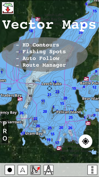
2. The maps include coverage of all NOAA marine vector charts (ENC), USACE inland river maps, and freshwater lake maps for more than 7K lakes.
3. The app also includes NOAA raster charts for some areas where NOAA ENC coverage is not available.
4. √ 1ft / 3ft depth contour maps for anglers for selected lake maps.
5. √ Long press to query the details of Marine object (Buoy, Lights, Obstruction etc).
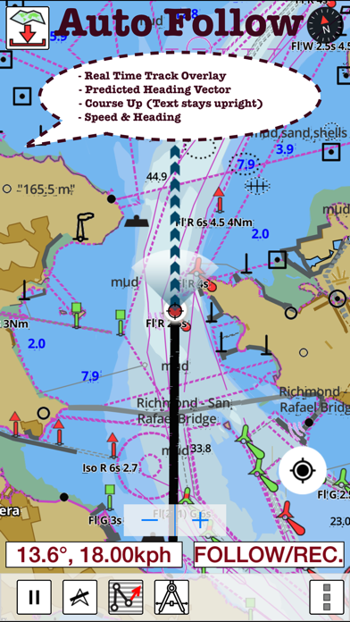
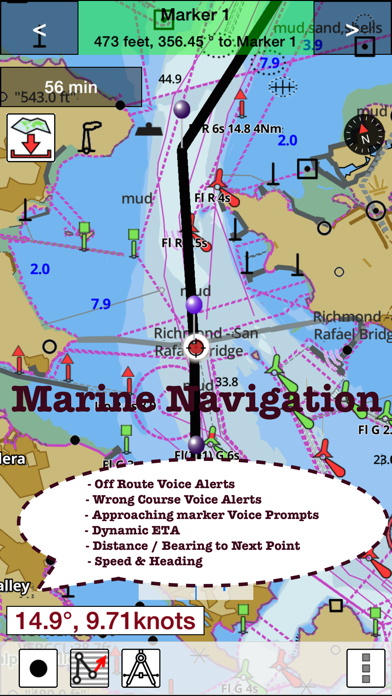
6. First marine GPS app to have route assistance with Voice Prompts for marine navigation.
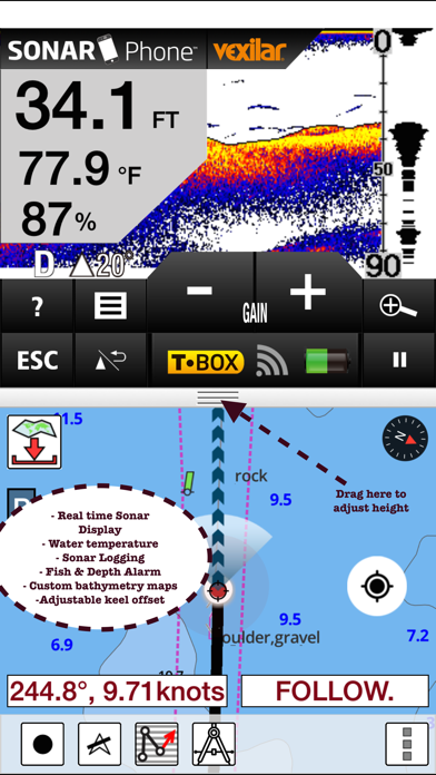
7. The charts include HD/1ft/3ft bathymetry where available.
8. √ Record tracks, Autofollow with real-time track overlay & predicted path vector.
9. It supports Nautical Charts course up orientation.
10. You can create new boating routes or import existing GPX/KML routes.
11. √ Supports GPX/KML for boating route editing/import.
12. Liked i-Boating? here are 5 Navigation apps like Boating Asia&Africa HD; Boating Hawaii Nautical charts; C-MAP: Boating; Boating Asia&Africa; Boating US&Canada HD;
Or follow the guide below to use on PC:
Select Windows version:
Install i-Boating: USA Marine Charts app on your Windows in 4 steps below:
Download a Compatible APK for PC
| Download | Developer | Rating | Current version |
|---|---|---|---|
| Get APK for PC → | Bist LLC | 4.33 | 107.0.0 |
Download on Android: Download Android
Waste of money for N Californians
Worked perfect for me
Easy to use marine navigation app
Boat Gps
 PC Apps