
Last Updated by JIDE Software, Inc. on 2025-02-22
What is Planit Pro?
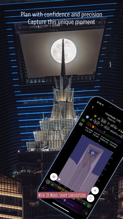
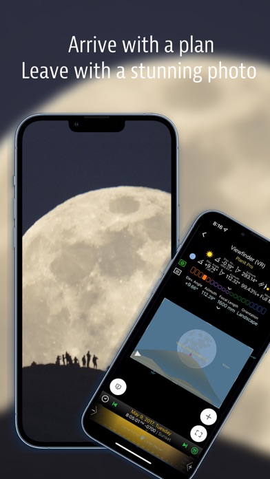
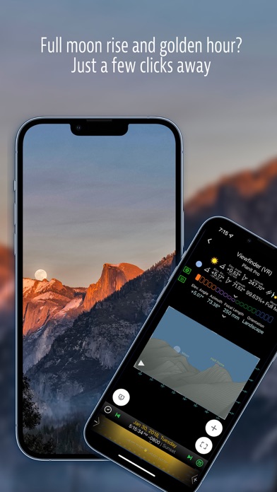
Planit Pro is an all-in-one solution for landscape photographers, travel photographers, nature photographers, and those interested in night photography, city photography, time-lapse, star-trails, milky way or astrophotography. The app leverages map and simulated viewfinder technologies to provide necessary tools for photographers to pre-visualize the scene in combination with the ground subjects and the celestial objects such as the Sun, the Moon, Stars, Star-trails, and Milky Way.
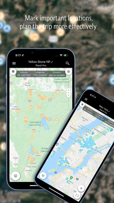
1. In the Planit Pro app, we packed it with features - from location scouting such as GPS coordinates, elevations, distance, elevation gain, clear view, focal length, depth of field (DoF), hyperfocal distance, panorama, and aerial photography, to the Ephemeris features such as the sunrise, sunset, moonrise, moonset time and direction, twilight time, special hours of the day, sun/moon finder, major stars, constellations, nebulae azimuth and elevation angle, star trail planning, time-lapse calculation and simulation, sequence calculation and simulation, milky way searching, solar eclipse and lunar eclipse, exposure/ND filter calculator, light meter, rainbow position prediction, tide height, and tide search, etc.
2. Planit Pro is an all-in-one solution that is designed to leverage the map and simulated viewfinder technologies to provide the necessary tools for photographers to pre-visualize the scene in combination with the ground subjects and the celestial objects such as the Sun, the Moon, Stars, Star-trails and Milky Way.
3. This is a special call to landscape photographers, travel photographers, nature photographers, and those who are interested in night photography, city photography, time-lapse, star-trails, milky way or astrophotography: look no more, this is the ultimate app for you - the Planit Pro.
4. However, for landscape photographers, being able to previsualize the scene before going there will greatly reduce the chance of being caught unprepared and will greatly increase the chance of getting better photos.
5. Whatever you want for your landscape photography, it is there in the Planit Pro.
6. Photographers use various tools to help them pre-visualizing the scene.
7. Landscape photography is an adventure in the natural world.
8. All the information is either represented on the map as an overlay or visually presented in simulated viewfinders (VR, AR, picture, or street view), just like you look through your camera's viewfinder.
9. If you preload the offline elevation files and the offline mbtiles maps, you can use the app fully offline without the need for network connections.
10. Most importantly, it will make you enjoy landscape photography even more.
11. He introduced the idea of "previsualization", which involved the photographer imagining what he wanted his final print to look like before he even took the photo.
12. Liked Planit Pro? here are 5 Photo & Video apps like PREVIEW: Planner for Instagram; Planoly: Social Media Planner; Feed Preview for Insta・Planner; My Feed・Grid Preview & Planner; Template Planner for Instagram;
Or follow the guide below to use on PC:
Select Windows version:
Install Planit Pro: Photo Planner app on your Windows in 4 steps below:
Download a Compatible APK for PC
| Download | Developer | Rating | Current version |
|---|---|---|---|
| Get APK for PC → | JIDE Software, Inc. | 4.78 | 10.7.9 |
Get Planit Pro on Apple macOS
| Download | Developer | Reviews | Rating |
|---|---|---|---|
| Get $9.99 on Mac | JIDE Software, Inc. | 1305 | 4.78 |
Download on Android: Download Android
- Location scouting such as GPS coordinates, elevations, distance, elevation gain, clear view, focal length, depth of field (DoF), hyperfocal distance, panorama, and aerial photography
- Ephemeris features such as the sunrise, sunset, moonrise, moonset time and direction, twilight time, special hours of the day, sun/moon finder, major stars, constellations, nebulae azimuth and elevation angle, star trail planning, time-lapse calculation and simulation, sequence calculation and simulation, milky way searching, solar eclipse and lunar eclipse, exposure/ND filter calculator, light meter, rainbow position prediction, tide height, and tide search, etc.
- Information represented on the map as an overlay or visually presented in simulated viewfinders (VR, AR, picture, or street view)
- Offline elevation files and offline mbtiles maps for use without network connections
- License agreement and privacy policy available at provided links.
- High performance and capabilities
- Thoughtfully put together and easy to use
- Online tutorials are helpful
- Facilitates visualizing photo and video shoots
- Includes a lot of features that photographers need
- Developed by someone with both IT technical and photography knowledge
- None mentioned in the review
Bed photo planning app period
Excellent app for those into astrolandscape photography
Awesome Complete Package
So good, I cannot believe it.
 PC Apps