Last Updated by Hunter Research and Technology, LLC on 2025-04-25
What is Nav Camera? Nav Camera is a photography and video recording app that uses navigation, augmented reality, and image processing engines to create data overlays. The app is developed by a top iOS developer and benefits from over 10 years of development and testing heritage. It is used by professionals such as surveyors, geologists, architects, engineers, competitive sportsmen, first responders, military personnel, and search and rescue workers around the world.
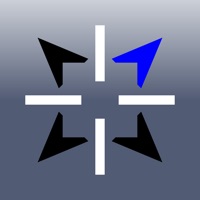
1. Nav Camera includes features for serious users including multiple reticles (three types of crosshairs and an SLR-style focus/exposure indicator), colored lens filters to improve use in dark conditions and preserve night vision, and multiple position formats including military grid reference system (MGRS), universal transverse Mercator (UTM), British/Irish National Grids, and six latitude/longitude variations.
2. Nav Camera uses the proven navigation, augmented reality, and image processing engines from the well known Theodolite app to create a new app that focuses on photogaphy and video recording with data overlays.
3. The app has been crafted with attention to detail by a top iOS developer, and benefits from over 10 years of development and testing heritage, along with real world usage by surveyors, geologists, architects, engineers, competitive sportsmen, first responders, military personnel, and search and rescue workers around the world.
4. Find out why apps like Nav Camera and Theodolite, and their field-proven results, are featured in Apple Keynotes, written up in magazine articles and professional journals, and used by everyday explorers and pro users around the world.
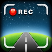
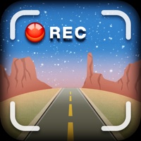
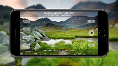
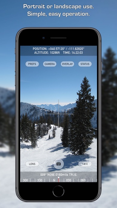
5. Nav Camera lets you take photographs and record movies in landscape and portrait orientations with geo-location overlays and custom notes.
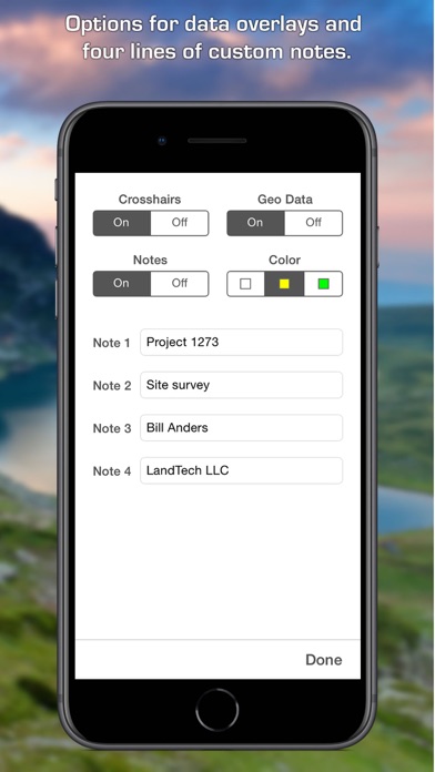
6. You can enter up to four lines of custom notes to be rendered into the overlay, which is perfect for job descriptions, project names, company/staff information, invoice numbers, or additional comments/documentation.
7. Optional datums include NAD-27, NAD-83, OSGB-36, ED-50, and hundreds of others, covering regions and countries on all continents around the world.
8. Overlay data is updated in every frame when recording movies, which is great for documenting dynamic scenes or scanning an area.
9. The optional "Datum Pack" adds over 220 geodetic datums to the app for more accurate position and altitude computation from GPS data.
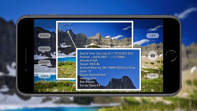
10. Geo-location overlays include date, time, position, altitude, GPS datum, and compass bearing.
11. Various parts of the overlay can be turned on or off, and multiple overlay colors are available.
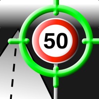
12. Liked Nav Camera? here are 5 Navigation apps like We Camera 03 | Street View App; GPS Camera 55. Field Survey; Speedometer Limit Camera; RadarAll Speed Camera Detector; Car Camera DVR;
GET Compatible PC App
| App | Download | Rating | Maker |
|---|---|---|---|
 Nav Camera Nav Camera |
Get App ↲ | 34 4.03 |
Hunter Research and Technology, LLC |
Or follow the guide below to use on PC:
Select Windows version:
Install Nav Camera app on your Windows in 4 steps below:
Download a Compatible APK for PC
| Download | Developer | Rating | Current version |
|---|---|---|---|
| Get APK for PC → | Hunter Research and Technology, LLC | 4.03 | 1.2.3 |
Get Nav Camera on Apple macOS
| Download | Developer | Reviews | Rating |
|---|---|---|---|
| Get $3.99 on Mac | Hunter Research and Technology, LLC | 34 | 4.03 |
Download on Android: Download Android
- Take photographs and record movies in landscape and portrait orientations with geo-location overlays and custom notes.
- Geo-location overlays include date, time, position, altitude, GPS datum, and compass bearing.
- Overlay data is updated in every frame when recording movies.
- Enter up to four lines of custom notes to be rendered into the overlay.
- Various parts of the overlay can be turned on or off, and multiple overlay colors are available.
- Multiple reticles (three types of crosshairs and an SLR-style focus/exposure indicator).
- Colored lens filters to improve use in dark conditions and preserve night vision.
- Multiple position formats including military grid reference system (MGRS), universal transverse Mercator (UTM), British/Irish National Grids, and six latitude/longitude variations.
- Optional "Datum Pack" adds over 220 geodetic datums to the app for more accurate position and altitude computation from GPS data.
- Works on any iPhone or iPod Touch with camera, running iOS 11.4 or later.
- Provides all the necessary information for helping coworkers, friends, and family with work and play-related activities.
- Supports locations in UTMs, which is very helpful for documenting locations.
- Works flawlessly and is simple and effective.
- Developer provides excellent support and responds quickly to inquiries.
- None mentioned.
UTM Zone Selection / Excellent Developer Response
It couldn’t be any easier 😃
Works great
Great app
 PC Apps