Published by Casa Editrice Tabacco S.r.l. on 2021-03-04
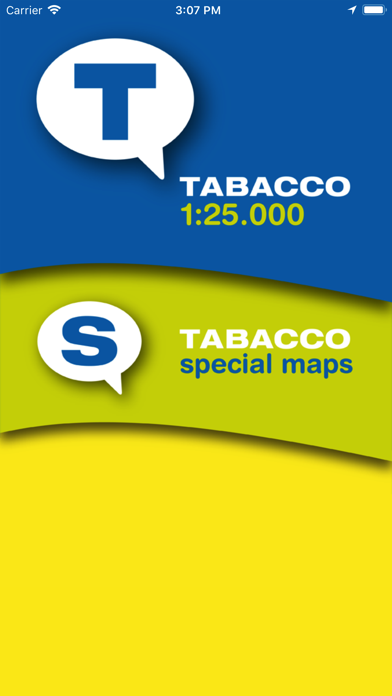
What is TABACCOmapp? The TABACCO maps app offers high-quality digital maps for hiking, trekking, Nordic walking, MTB excursions, snowshoeing, and ski mountaineering. The app is free, and users can purchase Tabacco maps divided into modules. The app also allows users to share their trips on a community website and review their trips in 3D. The app features zoom, track record, signals, sharing, import, photo, AR+, catalogue of maps, and safety service.
1. AR+: Using the Augmented Reality (AR+) facility, when you look at the horizon with your device you will be able to recognize mountain peaks with their name and height, mountain cols and passes, mountain refuges, bivouacs and locations, based on a user-defined kilometric distance scale.
2. This function allows users, who must first have registered, free of charge, on the web site, to indicate someone they trust who, if required, will be able to follow the excursion in real time, also with a 3D display.
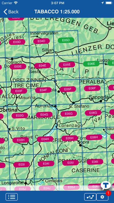
3. CATALOGUE OF MAPS – How to buy them: From the application itself, you can access a catalogue that provides images of maps already purchased, of those available for purchase and of those that will shortly be available.
4. The importance of this function is essentially that of being able to give the hiker’s last known position to the rescue services, in the unfortunate event of an accident.
5. IMPORT: It’s possible to export your own trail, and just as easy to import one suggested by a friend and supplied in the form of a .gpx file, complete with waypoints.
6. The application is suitable not only for hiking, trekking and Nordic Walking enthusiasts, but also for those who prefer MTB excursions or, in winter, snowshoeing or ski mountaineering.
7. The application is free and you can buy the Tabacco maps divided into modules map.
8. TRACK RECORD: Via the GPS incorporated in the device, you can save your own excursions, assigning a different color and a description to each one for instant recognition.
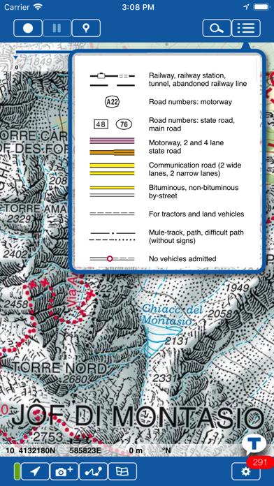
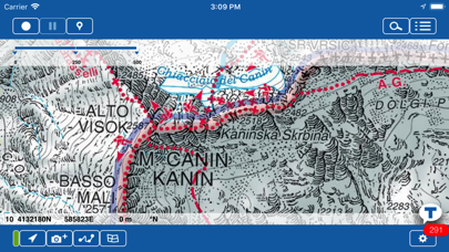
9. ZOOM: The maps can be zoomed out for an overview, or in to explore the terrain in minute detail.
10. SHARING: Trails and waypoints are immediately available for sending by e-mail by simply TAPPING an icon.
11. This function is only active if a mobile telephone signal is available.
12. Liked TABACCOmapp? here are 5 Navigation apps like Google Maps; Waze Navigation & Live Traffic; ParkMobile - Find Parking; Transit • Subway & Bus Times; SpotHero: #1 Rated Parking App;
GET Compatible PC App
| App | Download | Rating | Maker |
|---|---|---|---|
 TABACCOmapp TABACCOmapp |
Get App ↲ | 9 2.33 |
Casa Editrice Tabacco S.r.l. |
Or follow the guide below to use on PC:
Select Windows version:
Install TABACCOmapp app on your Windows in 4 steps below:
Download a Compatible APK for PC
| Download | Developer | Rating | Current version |
|---|---|---|---|
| Get APK for PC → | Casa Editrice Tabacco S.r.l. | 2.33 | 2.6.2 |
Get TABACCOmapp on Apple macOS
| Download | Developer | Reviews | Rating |
|---|---|---|---|
| Get Free on Mac | Casa Editrice Tabacco S.r.l. | 9 | 2.33 |
Download on Android: Download Android
- Zoom: Maps can be zoomed out for an overview or in to explore the terrain in detail.
- Track record: Users can save their own excursions via the GPS incorporated in the device and assign a different color and description to each one for instant recognition.
- Signals: Users can identify various points of interest (POI) within the excursion and assign icons selected from a large number available.
- Sharing: Trails and waypoints are immediately available for sending by email by tapping an icon.
- Import: Users can export their own trail and import one suggested by a friend in the form of a .gpx file, complete with waypoints.
- Photo: Photos taken along the way will be saved and georeferenced for possible future use.
- AR+: Users can use the Augmented Reality (AR+) facility to recognize mountain peaks with their name and height, mountain cols and passes, mountain refuges, bivouacs, and locations based on a user-defined kilometric distance scale.
- Catalogue of maps: Users can access a catalogue that provides images of maps already purchased, of those available for purchase, and of those that will shortly be available.
- Safety service: Users can indicate someone they trust who, if required, will be able to follow the excursion in real-time, also with a 3D display. This function is only active if a mobile telephone signal is available.
- Exhaustive set of marked and unmarked trails for the Dolomites area
- Offers a new, digital level of hiking experience
- Significant branches of marked (CAI) trails are missing from the app maps
- Buggy and can't open downloaded maps
- No help available
- Zooming in the map results in poor quality image
- Maps not viewable over the internet without payment
- Map regions are very small and require multiple maps
- Most map sections are not yet available for purchase or viewing
- Cannot pinch to zoom in/out or twist to reorient the map
- Map is simply a JPG image of the print maps, with less detail than the print version
- General interface is not very refined and needs improvement.
App maps not as complete as paper version
Usual bad software
Awesome. But not.
Could be good, not there yet
 PC Apps