Last Updated by Corporate Smalltalk Consulting Ltd on 2025-04-19
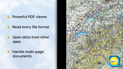
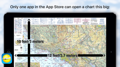
1. Got a PDF or a TIFF of an Aeronautical chart? Is that chart 31x24 inches with typography the size of a grain of rice? None of the document readers in the App store can view and scroll your chart with ease? We can, we are happy to work with files that need to become gigantic in size to read the fine print.
2. Using these charts and other tools, pilots are able to determine their position, safe altitude, best route to a destination, navigation aids along the way, alternative landing areas in case of an in-flight emergency, and other useful information such as radio frequencies and airspace boundaries.
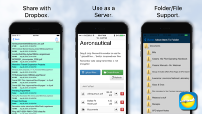
3. Note we don't supply the charts you must find those, in PDF, TIFF or JPEG/PNG formats, but once you have them, then you can view them with ease, either stored within the app via iTunes sharing, or passively cached from your Dropbox account.
4. We support internal and external bookmarking, printing, TIFF to PDF conversion & free-form rotation, multi-page PDF books (any size, thousands of pages), and multi-page FAX/TIFF documents.
5. We can read almost every image file format: AVS, BMP, CUR, DIB, GIF, ICON, JNG, JP2, JPEC, JPEG, JPEG2000, JPG, MAT, MIFF, MTV, MVG, PBM, PCX, PGM, PICT, PIX, PNG, PNG8, PNG24, PNG32, PNM, PPM, RLE, SGI, TGA, TIFF, TIFF, TIM, VIFF, WBMP, WPG, SBM and XPM.
6. An aeronautical chart is a map designed to assist in navigation of aircraft, much as nautical charts do for watercraft, or a roadmap for drivers.
7. We use our accelerated PDF viewing logic, and combined with our TIFF decoder we can deal most image formats.
8. For charts under 36 megapixels effective resolution zoom and scroll time is ZERO! Above that we take an eye blink.
9. There are charts for all land masses on Earth, and long-distance charts for trans-oceanic travel.
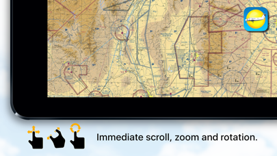
10. Expanding on our LargeViewer technology then means size is not a problem.
11. Can act as a cloud server so you can upload/download/mange files and folders from your desktop browser.
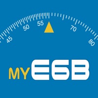
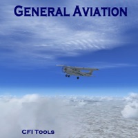
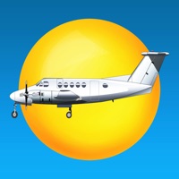
12. Liked Aeronautical & Aviation Charts? here are 5 Navigation apps like E6B Aviation Calculator; CFI Tools General Aviation; Aviation Altimeter; Direct-To Aviation GPS VFR IFR; Aviation NavCalc;
GET Compatible PC App
| App | Download | Rating | Maker |
|---|---|---|---|
 Aeronautical & Aviation Charts Aeronautical & Aviation Charts |
Get App ↲ | 1 1.00 |
Corporate Smalltalk Consulting Ltd |
Or follow the guide below to use on PC:
Select Windows version:
Install Aeronautical & Aviation Charts app on your Windows in 4 steps below:
Download a Compatible APK for PC
| Download | Developer | Rating | Current version |
|---|---|---|---|
| Get APK for PC → | Corporate Smalltalk Consulting Ltd | 1.00 | 2.6.0 |
Get Aeronautical & Aviation Charts on Apple macOS
| Download | Developer | Reviews | Rating |
|---|---|---|---|
| Get $15.99 on Mac | Corporate Smalltalk Consulting Ltd | 1 | 1.00 |
Download on Android: Download Android
The idea is good, but crashs a lot.
Works nice! Doesn
 PC Apps