
Last Updated by Muammer SAHINGIRAY on 2025-06-16
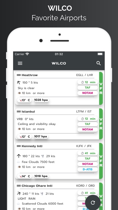
1. Briefing page provides METAR, TAF data for airports which are 25 nm range of your flight.
2. METAR wind data is split into vectors according to runway heading and displayed on weather page.
3. Wilco has a Flight Computer to calculate Climb, Cruise and Descend time, speed and durations with fuel consumption.
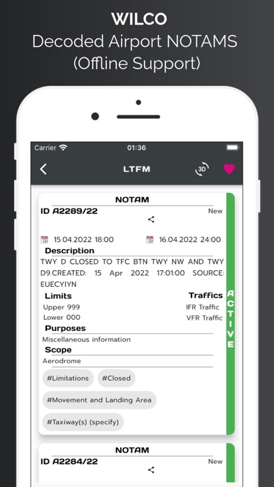
4. Also departure and arrival airport runway data, and NOTAM data provided in briefing.
5. With advanced features of the map page user can see live coordinates of current location, speed and altitude information.
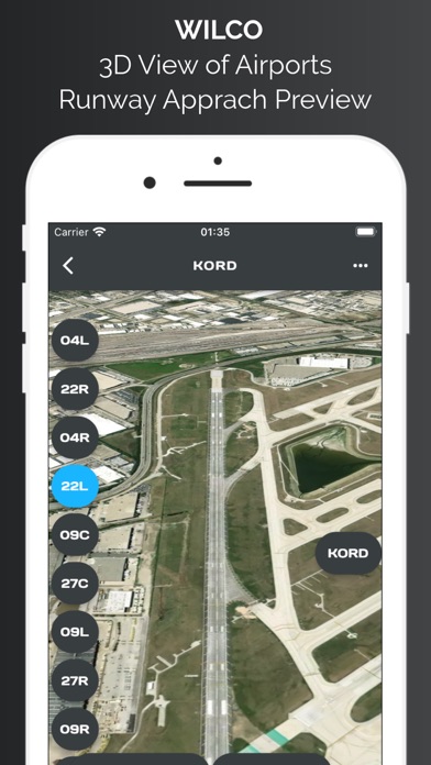
6. All airports procedures are available in airport data section.
7. User can select departure and arrival airport and user may select appropriate procedures for SID, STAR, or approach.
8. To start with, you may search an airport from database and add it to favorites for offline usage of the data.
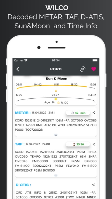
9. METAR, TAF, D-ATIS(for provided US Aiports), NOTAM, Time zone and Sun and Moon rise and set times, procedures for airports.
10. App provides weather charts for aviation specific usage.
11. Wilco has a converter for aviation calculations and provides holding entry calculations and gives you instructions.
12. Liked WilCo? here are 5 Weather apps like Garmin Pilot; Wx24 Pilot; RunwayMap - #1 Pilot Community; Aeromet - Pilot App; Pilot Charts;
Or follow the guide below to use on PC:
Select Windows version:
Install WilCo - Pilot Aviation Weather app on your Windows in 4 steps below:
Download a Compatible APK for PC
| Download | Developer | Rating | Current version |
|---|---|---|---|
| Get APK for PC → | Muammer SAHINGIRAY | 4.21 | 2.6.2 |
Get WilCo on Apple macOS
| Download | Developer | Reviews | Rating |
|---|---|---|---|
| Get Free on Mac | Muammer SAHINGIRAY | 14 | 4.21 |
Download on Android: Download Android
 PC Apps