Last Updated by Josue V. Herrera on 2024-10-23

1. - Visual guidance (a cute little ball) that moves around the compass and always points to the geographical coordinates where the hike started.
2. - A graphical comparison between all your saved walks, segmented in the last seven days, the current month and a custom date range you can choose.
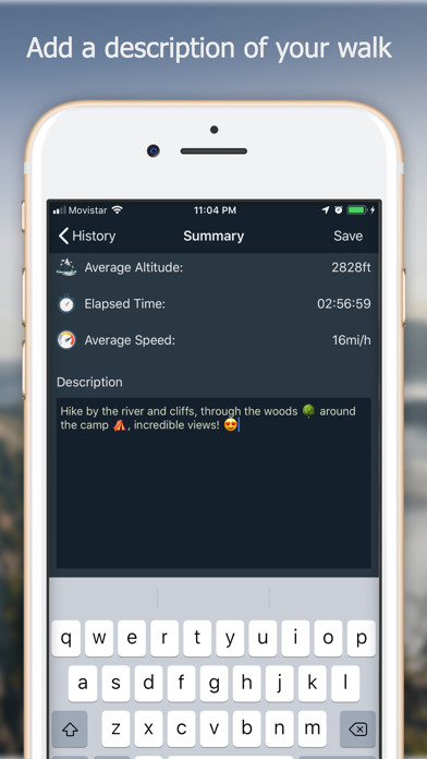
3. - When the hike is over the app shows you a summary of your walk, where you can add a description and choose to save it or not.
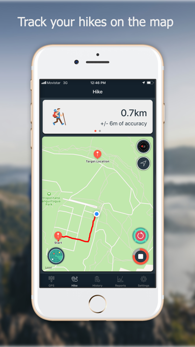
4. - You can load a hike and visualize it in the map (at the Hike tab) including the distance traveled and rest of information.
5. - Touching a map annotation shows the coordinates for that location with the option to share it with apps like Waze, Google Map, or just plain text.
6. - A summary of the distance and top altitude you have covered and reach during your saved hikes.
7. - You can delimiter your hike inside a circular safe zone, and the app warns you when you enter or exit this zone.
8. - You can choose from two of the available algorithms used to measure the distance covered during your hikes.
9. Navstar process and segment the raw data your device (GPS receiver) is getting from the satellite network.
10. - You can edit a hike and change the associated description.
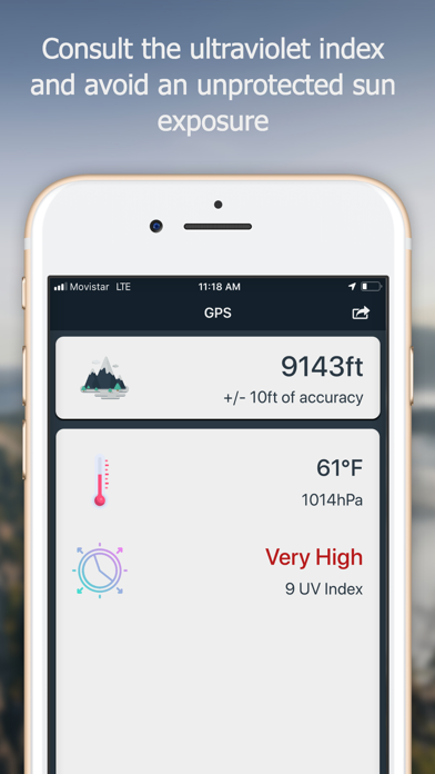
11. - You can take a screenshot of your current altitude and location.
12. Liked Navstar? here are 5 Navigation apps like GPS Kit - Offline GPS Tracker; GPS Utility; GPS; Boating US West & Alaska GPS chart navigator; Great Lakes GPS Nautical Chart;
Or follow the guide below to use on PC:
Select Windows version:
Install Navstar - GPS & Map for Hikers app on your Windows in 4 steps below:
Download a Compatible APK for PC
| Download | Developer | Rating | Current version |
|---|---|---|---|
| Get APK for PC → | Josue V. Herrera | 1 | 0.6.2 |
Download on Android: Download Android
 PC Apps