
Last Updated by Tatiana Fedorchenko on 2025-05-09
What is South Korea? South Korea Offline GPS Navigation is a mobile navigation application developed by Travel Monster. It is an offline app that stores all map data on the phone memory card for offline usage. The app supports offline routing functionality, turn-by-turn voice guidance, and displays the user's position on a map using GPS sensor data. It also supports Points of Interest (POI) and works without an internet connection.
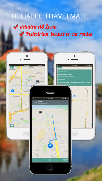
1. South Korea Offline GPS Navigation app will display your position on a map using GPS sensor data, and provides precise route calculation, touch screen functionality and supports Points of Interest (POI).
2. South Korea Offline GPS Navigation supports offline routing functionality including turn-by-turn voice guidance.
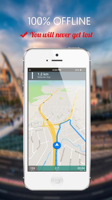
3. Travel Monster South Korea Offline GPS Navigation is a mobile navigation application which works completely offline.
4. South Korea Offline GPS Navigation is developed by Travel Monster .
5. All map data is stored on the phone memory card for offline usage.
6. The app is completely offline and works without an internet connection.
7. It will work completely offline afte the update on launch.
8. * Our App requires a internet connection once, only during the initial launch.
9. Liked South Korea? here are 5 Navigation apps like Subway Korea; KakaoMap - Korea No.1 Map; BringGo Korea; South Korea Map; Navmii Offline GPS South Korea;
Or follow the guide below to use on PC:
Select Windows version:
Install South Korea : Offline GPS Navigation app on your Windows in 4 steps below:
Download a Compatible APK for PC
| Download | Developer | Rating | Current version |
|---|---|---|---|
| Get APK for PC → | Tatiana Fedorchenko | 1 | 1.0 |
Get South Korea on Apple macOS
| Download | Developer | Reviews | Rating |
|---|---|---|---|
| Get $9.99 on Mac | Tatiana Fedorchenko | 0 | 1 |
Download on Android: Download Android
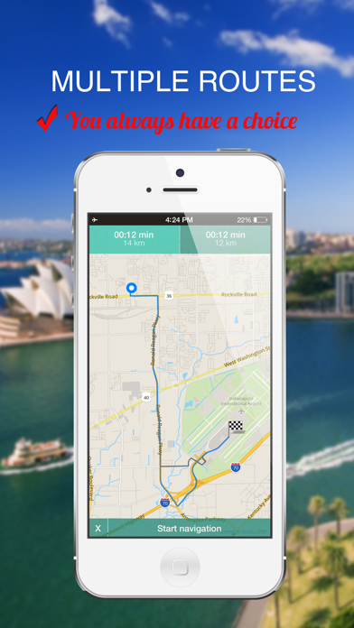
- Fast, easy, and fully offline maps
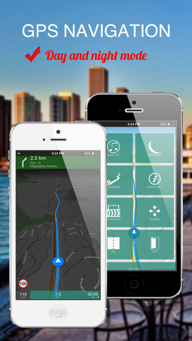
- Car, bicycle, and pedestrian navigation modes
- Offline search for addresses and places (POIs)
- Offline routing, re-routing, navigation, and directions
- Points of Interest, favorites, public transportation stops
- Day/Night view modes
- Lane guidance, speed limit display
- Speed-dependent map zooming
- Map alignment according to compass
- Spoken directions in many languages
- Complete offline functionality (store downloaded maps in the phone memory)
- Compact offline HIGH DETAILED 17x ZOOM vector maps
- GPX and navigation tracks support
- Requires internet connection only during initial launch, works completely offline after update on launch.
 PC Apps