
에 의해 게시 Roberto Panetta
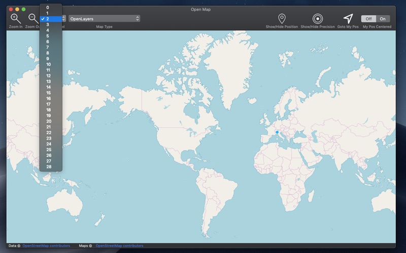
1. Open Map covers all the world exactly as other well know proprietary formats but with more then 60 map types with different style, graphic and also data, always up to date, available with 1 click with a resolution level ranging from 0 to 28.
2. A must have for anyone working with maps, from designers to developers, to evaluate map types or to produce PDF map images of various area or other purposes.
3. Open Map brings on the Mac many maps of the open standard map world.
4. We have also an iOS version for the iPhone and the iPad with similar features.

또는 아래 가이드를 따라 PC에서 사용하십시오. :
PC 버전 선택:
소프트웨어 설치 요구 사항:
직접 다운로드 가능합니다. 아래 다운로드 :
설치 한 에뮬레이터 애플리케이션을 열고 검색 창을 찾으십시오. 일단 찾았 으면 Open Map 검색 막대에서 검색을 누릅니다. 클릭 Open Map응용 프로그램 아이콘. 의 창 Open Map Play 스토어 또는 앱 스토어의 스토어가 열리면 에뮬레이터 애플리케이션에 스토어가 표시됩니다. Install 버튼을 누르면 iPhone 또는 Android 기기 에서처럼 애플리케이션이 다운로드되기 시작합니다. 이제 우리는 모두 끝났습니다.
"모든 앱 "아이콘이 표시됩니다.
클릭하면 설치된 모든 응용 프로그램이 포함 된 페이지로 이동합니다.
당신은 아이콘을 클릭하십시오. 그것을 클릭하고 응용 프로그램 사용을 시작하십시오.
다운로드 Open Map Mac OS의 경우 (Apple)
| 다운로드 | 개발자 | 리뷰 | 평점 |
|---|---|---|---|
| $7.99 Mac OS의 경우 | Roberto Panetta | 0 | 1 |
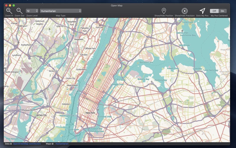
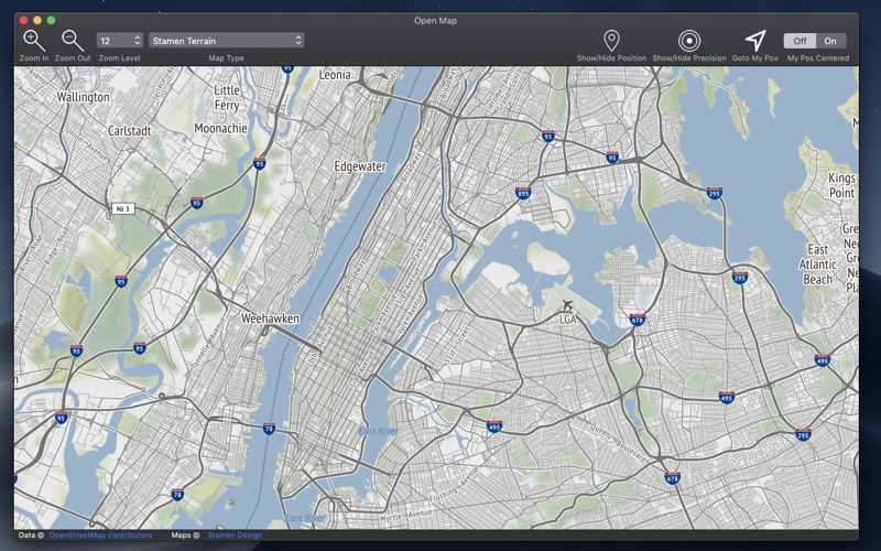
Open Map brings on the Mac many maps of the open standard map world. Open Map covers all the world exactly as other well know proprietary formats but with more then 60 map types with different style, graphic and also data, always up to date, available with 1 click with a resolution level ranging from 0 to 28. A must have for anyone working with maps, from designers to developers, to evaluate map types or to produce PDF map images of various area or other purposes. FEATURES • Open standard map world inside a Cocoa native Mac application • Scroll, move, zoom in and out to any level you like of any point of the globe • Custom zoom level also from menu • Switch map time at any time at any zoom. • Export as PDF, PNG, TIFF, JPEG any visualized map at selected position and zoom level • Visualize your position and precision range via geo wi-fi • Position update over the map if you are moving SOME OF THE 65 AVAILABLE MAPS • Wikimedia • Humanitarian • Black & White • OpenTopo • Hike & Bike • Hydda • Toner • Terrain • Watercolor • Positron • Dark Matter • Flat Blue • Roads • Hybrid • Contour • Grayscale • Street • Topo • Imagery • Shaded Relief • LightGray • NatGeo • Delorme • Ocean • OpenCycle • transport • Landscape • Pioner • Atlas • Outdoor • Satellite • Lyzidiamond • Street Satellite ALSO AVAILABLE FOR We have also an iOS version for the iPhone and the iPad with similar features. Search on the iOS App Store for 'Open-Map'

자가격리자 안전보호

정부24(구 민원24)

해피오더

티머니GO(고속버스 시외버스 따릉이 씽씽)

투썸하트

잼페이스 : 유튜브 뷰티 영상 모음 앱

T world

직방 - No.1 부동산 앱

Bill Letter

LH청약센터

해피포인트카드

L.POINT - 엘포인트

TheDayBefore (디데이 위젯)

Pinterest (핀터레스트): 수백만개의 아이디어

Chanel Code
 PcMac 한국어