Published by Mac George Roberts on 2021-07-22

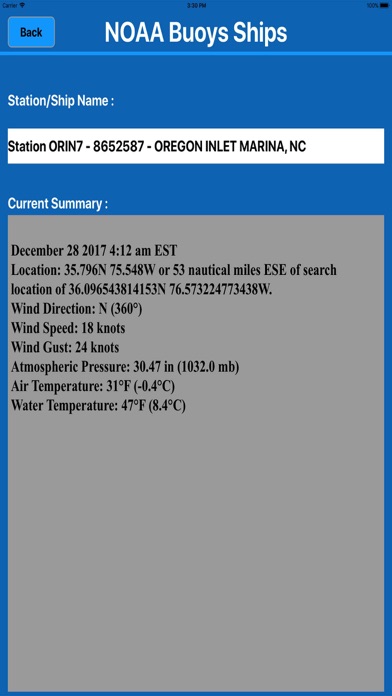
1. Retrieved information is relevant to buoy station or ship Location address, Wind Direction, Wind Speed, Wind Gust, Atmospheric Pressure, Pressure Tendency, Air Temperature, Dew Point, Water Temperature, Significant Wave Height, Visibility etc.
2. Sailors can check and find the nearest buoy stations and ships as a list showing station name, ship name, date and time.
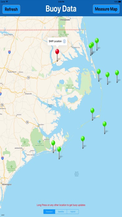
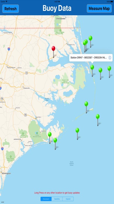
3. All buoy stations and ships are displayed on the map based on the user current location within 100 miles radius while boating.
4. Map retrieves real-time weather data from NOAA's NDBC (National Data buoy Center) and displays it on map in an easy to understand format.
5. See live stations and ship positions for any desired location including GPS.
6. The Information Provided on this app is for Informational Purposes Only, "NOT TO BE USED FOR NAVIGATION".
7. Liked NOAA Buoys & Ships MGR? here are 5 Navigation apps like Buoys Stations Data (NOAA); Noaa Buoys Stations MGR; Noaa Wrecks & Obstructions MGR; i Sail GPS : NOAA USA Charts;
GET Compatible PC App
| App | Download | Rating | Maker |
|---|---|---|---|
 NOAA Buoys & Ships MGR NOAA Buoys & Ships MGR |
Get App ↲ | 2 1.00 |
Mac George Roberts |
Or follow the guide below to use on PC:
Select Windows version:
Install NOAA Buoys & Ships MGR app on your Windows in 4 steps below:
Download a Compatible APK for PC
| Download | Developer | Rating | Current version |
|---|---|---|---|
| Get APK for PC → | Mac George Roberts | 1.00 | 1.3 |
Get NOAA Buoys & Ships MGR on Apple macOS
| Download | Developer | Reviews | Rating |
|---|---|---|---|
| Get $0.99 on Mac | Mac George Roberts | 2 | 1.00 |
Download on Android: Download Android
Government Manipulated
 PC Apps