Last Updated by Jian Li on 2025-03-31
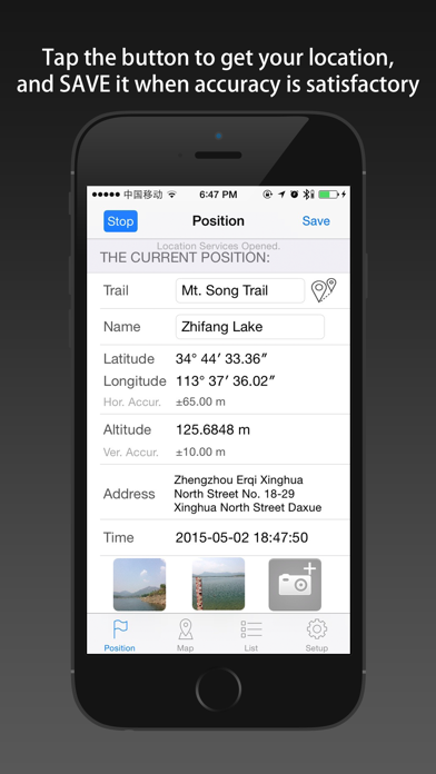
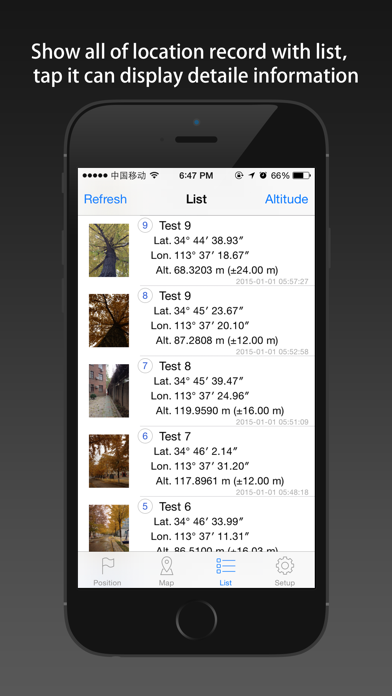

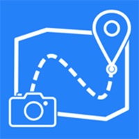
1. In the process of marching, you can record the current position of longitude, latitude, altitude, address, and photos.
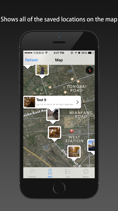
2. KML format can be derived position list file, the file can be opened by Google Earth software.
3. The use of mobile phone GPS sensors, acquire and save the current position of longitude, latitude, altitude and address information.
4. The Location information is under the WGS84 coordinate system, its accuracy depends on the phone acquisition and positioning environment.
5. In both positioning function and display on the map function, optimization software made possible, make the minimum power consumption and the network flow.
6. All of data can be derived, including photos, and can be opened in the post-processing software such as Google Earth.
7. The software automatically shut down into the background positioning function, shut down the background refresh function.
8. Statistics all the location of the elevation change information, to draw the chart way into the picture.
9. Don't record track, only record the location of the interesting point.
10. The positioning function whether open is completely determined by the user, provide switch button for operation, and use it every time you open the can.
11. This is almost the most green location record tool in the App Store.
12. Liked LocRec? here are 5 Navigation apps like Dash Cam - Record Trips; Gps Status - record your track; Car Video Record; cars record; Lazy Diary: Auto record tracks;
Or follow the guide below to use on PC:
Select Windows version:
Install LocRec - Record Location with Photos by Route app on your Windows in 4 steps below:
Download a Compatible APK for PC
| Download | Developer | Rating | Current version |
|---|---|---|---|
| Get APK for PC → | Jian Li | 1 | 2.5.1 |
Download on Android: Download Android
 PC Apps