Last Updated by V PUGAZHENTHI on 2024-12-17
What is Engineering Survey Calculator?
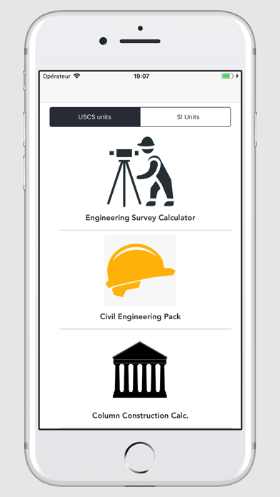
Engineering Survey Calculator is a mobile app that provides 33 calculators for different surveying, measurement, and civil engineering parameters. It is a handy tool for engineering surveyors and is available in both imperial (USCS) and metric (SI) units. The app is available for both iPad and iPhone.
1. Engineering Survey Calculator has got 33 Calculators for different Surveying,measurement and Civil Engineering Parameters.
2. - Available in Imperial (USCS) and Metric (SI) Units.
3. Liked Engineering Survey Calculator? here are 5 Utilities apps like Property Survey GPS; Indoor Survey; Poll / Survey; Quick Survey; Sierra Wireless Site Survey;
GET Compatible PC App
| App | Download | Rating | Maker |
|---|---|---|---|
 Engineering Survey Calculator Engineering Survey Calculator |
Get App ↲ | 0 1 |
V PUGAZHENTHI |
Or follow the guide below to use on PC:
Select Windows version:
Install Engineering Survey Calculator app on your Windows in 4 steps below:
Download a Compatible APK for PC
| Download | Developer | Rating | Current version |
|---|---|---|---|
| Get APK for PC → | V PUGAZHENTHI | 1 | 6.0 |
Get Engineering Survey Calculator on Apple macOS
| Download | Developer | Reviews | Rating |
|---|---|---|---|
| Get $2.99 on Mac | V PUGAZHENTHI | 0 | 1 |
Download on Android: Download Android
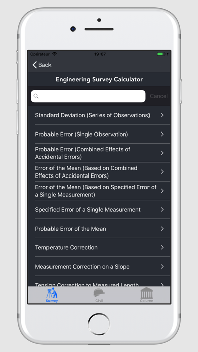
1. Standard Deviation (Series of Observations)
2. Probable Error (Single Observation)
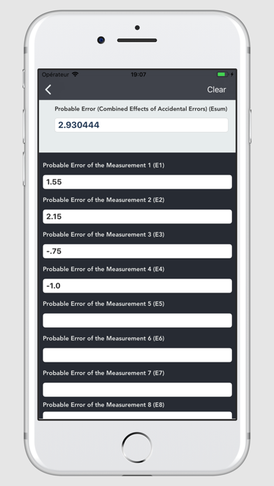
3. Probable Error (Combined Effects of Accidental Errors)
4. Error of the Mean (Based on Combined Effects of Accidental Errors)
5. Error of the Mean (Based on Specific Error of a Single Measurement)
6. Specified Error of a Single Measurement
7. Probable Error of the Mean
8. Temperature Correction
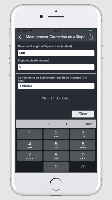
9. Measurement Correction on a Slope
10. Tension Correction to Measured Length
11. Sag Correction to Measured Length
12. Horizontal Distance (Slope Measurements)
13. Slope Correction (Slopes of 10% or less)
14. Slope Correction (Slopes greater than 10%)
15. Correction due to Incorrect Tape Length
16. Correction due to Nonstandard Tension
17. Sag Correction (Between Points of Support)
18. Departure from a Level Surface
19. Displacement (Horizontal Sights)
20. Combined Effect of Refraction and Curvature of Earth
21. Quantities of Material to be Excavated/Filled
22. Relative Accuracy required between directly connected Bench marks (First Order - Class I)
23. Relative Accuracy required between directly connected Bench marks (First Order - Class II)
24. Relative Accuracy required between directly connected Bench marks (Second Order - Class I)
25. Relative Accuracy required between directly connected Bench marks (Second Order - Class II)
26. Relative Accuracy required between directly connected Bench marks (Third Order)
27. Horizontal Distance between the Instrument and the Rod (Stadia Surveying)
28. Vertical Distance between the Instrument and the Rod (Stadia Surveying)
29. Distance (From Instrument Spindle to Rod - Horizontal Sights)
30. Stadia Constant
31. Photo Scale
32. Photo Scale (Using Focal Length)
33. Map Scale
 PC Apps