Last Updated by Juggernaut Technology, Inc. on 2025-05-01


What is Rivercast? Rivercast™ is an app that provides river level data through interactive maps and graphs. It offers official flood warnings and alerts from the National Weather Service, river stage height in feet, river flow rate in CFS, indications of approaching flood stage, current observations and recent history, NOAA river forecasts, and a map interface that shows where river gauges are located geographically. The app also has a search interface to find river gauges by waterway name, state, or NOAA 5 digit station ID, interactive graphs that can be customized, a favorites list for locations, and a widget to monitor favorite locations at any time.
1. Rivercast™ puts the river level data you need at your fingertips with its intuitive and interactive maps and graphs.
2. • Search interface to find river gauges by waterway name, state, or NOAA 5 digit station ID.
3. • This app uses NOAA and AHPS (Advanced Hydrologic Prediction Service) for its raw data for our custom graphing and mapping solutions.
4. Rivercast™ uses the latest observation and forecast data available, and requires an Internet connection for use.
5. NOAA and USGS estimates may sometimes slightly vary due to using different data models.
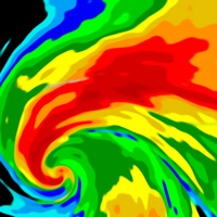
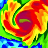
6. Rivercast's map not only shows you where the stations are, but color codes them when it can to give you an indication whether the location is at normal levels, approaching flood levels, or above flood stage.
7. Favorites, Map "Instant Observations", and Hydrograph data is viewable in feet or cfs (when available).
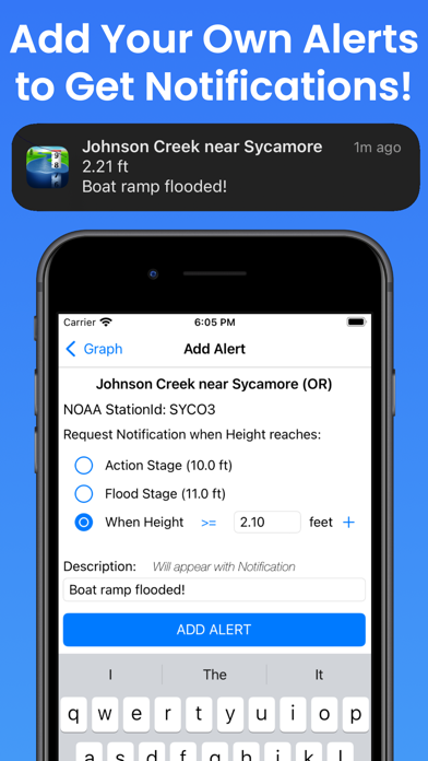
8. To customize your graphs for what's important to you, you can add your own level lines to mark things like sandbars, rocks, bridges, safe conditions, or whatever you would like.
9. Stage height should always be identical between USGS and NOAA.
10. • Customize your graphs by adding river levels that are relevant to you.
11. All observation and forecast data is in your local time (per your device) for your convenience.
12. Liked Rivercast? here are 5 Weather apps like Sea Level Rise; Smith Lake Water Level; Weather - The Weather Channel; WeatherBug – Weather Forecast; Yahoo!天気;
GET Compatible PC App
| App | Download | Rating | Maker |
|---|---|---|---|
 Rivercast Rivercast |
Get App ↲ | 9,757 4.70 |
Juggernaut Technology, Inc. |
Or follow the guide below to use on PC:
Select Windows version:
Install Rivercast - Levels & Forecasts app on your Windows in 4 steps below:
Download a Compatible APK for PC
| Download | Developer | Rating | Current version |
|---|---|---|---|
| Get APK for PC → | Juggernaut Technology, Inc. | 4.70 | 5.23 |
Get Rivercast on Apple macOS
| Download | Developer | Reviews | Rating |
|---|---|---|---|
| Get Free on Mac | Juggernaut Technology, Inc. | 9757 | 4.70 |
Download on Android: Download Android
- Official Flood Warnings & other alerts from the National Weather Service
- River stage height in Feet
- River flow rate in CFS (when available)
- Indications that a river is at or approaching flood stage
- Current observations and recent history
- NOAA river forecasts (when available)
- Map interface that shows where river gauges are located geographically
- Search interface to find river gauges by waterway name, state, or NOAA 5 digit station ID
- Interactive graphs that can be zoomed in, zoomed out, or panned
- Customizable graphs by adding river levels that are relevant to the user
- Favorites list for locations
- Shareable graphs via iMessage, Email, Facebook, or Twitter
- Widget to monitor favorite locations at any time
- Map that color codes river gauges to indicate normal levels, approaching flood levels, or above flood stage
- Latest observations from the map, search, or favorites
- Detailed interactive hydrograph that can be zoomed in, zoomed out, or panned
- Ability to add own level lines to mark sandbars, rocks, bridges, safe conditions, or other relevant information
- Latest observation and forecast data available
- Requires an Internet connection for use
- Favorites, Map "Instant Observations", and Hydrograph data is viewable in feet or cfs (when available)
- All observation and forecast data is in the user's local time
- USA-only river gauges reported
- Uses NOAA and AHPS for its raw data for custom graphing and mapping solutions
- Variances in CFS data between NOAA and USGS estimates may sometimes occur due to using different data models
- NOAA issues forecasts for many, but not all, rivers it monitors
- River gauges occasionally have technical problems transmitting their data or can get washed out during extreme flooding
- All stations that NOAA provides for public use are included in the app.
- Map layout and favorites make it quick and easy to use
- Comprehensive data on gauge stations
- Useful for outfitting businesses and fishing trips
- Efficient and professional customer service
- Limited history of river levels
- May not be able to predict river levels accurately beyond a few days to a week
Everyday Use and Reliability
Great App For Fisherman To Watch River Levels
Larry
Vital information!!!
 PC Apps