Last Updated by Flytomap on 2025-04-25

What is Lakes Texas GPS fishing charts? Flytomap is a navigation app that provides worldwide marine, lakes, and outdoor maps. It offers satellite images overlay on charts, terrain features overlay on charts, local weather forecast, and NOAA, USGS, DRG, Topo raster charts seamless with continuous updates from the official Government server. The app also features ActiveCaptain, a worldwide boaters and fishermen community, with 200,000+ captains.
1. Flytomap is committed to constant improvement, this App is developed with the help of professional boaters to get the best experience on the sea, we listen to our users and systematically add the most requested features.
2. √ iOS background mode - Flytomap works in background as well, you can swap with another app and receive/make calls send sms while track recording.
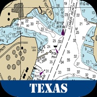
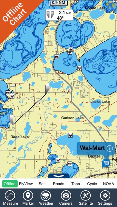
3. Texas Lakes - The whole coverage resident in the app.
4. Liked Lakes Texas GPS fishing charts? here are 5 Navigation apps like US East Charts Texas to Maine; Boating Texas Nautical Charts; US East HD from Texas to Maine; Texas Nautical Charts GPS - HD; TexaGPS™;
GET Compatible PC App
| App | Download | Rating | Maker |
|---|---|---|---|
 Lakes Texas GPS fishing charts Lakes Texas GPS fishing charts |
Get App ↲ | 2 1.00 |
Flytomap |
Or follow the guide below to use on PC:
Select Windows version:
Install Lakes Texas GPS fishing charts app on your Windows in 4 steps below:
Download a Compatible APK for PC
| Download | Developer | Rating | Current version |
|---|---|---|---|
| Get APK for PC → | Flytomap | 1.00 | 5.7 |
Get Lakes Texas GPS fishing charts on Apple macOS
| Download | Developer | Reviews | Rating |
|---|---|---|---|
| Get $9.99 on Mac | Flytomap | 2 | 1.00 |
Download on Android: Download Android
- Latitudes and Longitudes to go to your favorite places
- Search your favorite points directly
- Zoom, Rotate and Pan fast just by a finger touch
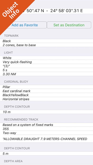
- Quick Object information just tapping, thanks to vector technology
- GPS Heading Vector Towards the direction movement
- Distance Measurement Tool to easily calculate the distance from one location to another
- Route planning, Waypoints - Insert the target/destination and see in real-time your speed, distance, and bearing
- Magnified Lens for all info
- Unlimited Tracks, Markers, Fishing Spots, Geo-tagged photos, records, and share via email, visible on Google, Flytomap Viewer, KMZ format - Store your track without the need for cellular data or mobile signal
- Select Depth Contours
- A la carte menu
- MOB - Man Over Board
- Quick WP - allows you to instantly record your position and show distance and bearing
- iOS background mode - Flytomap works in the background as well, you can swap with another app and receive/make calls send SMS while track recording.
- Optimized battery usage
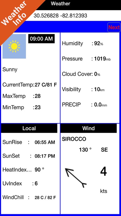
- Local Marine Weather forecast at a quick tap provide you:
- Day max and min temperature - Current temperature
- Significant wave height, Swell height, Swell period, Swell direction
- Tide data
- Sea temperature
- Wind Speed and direction
- Weather description
- Precipitation & Humidity
- Visibility
- Pressure
- Cloud cover in percentage
- Wind chill/Feels like Temperature
- Water Temperature
- Dew Point Temperature
- Heat Index Temperature
- Our charts are installed on: GARMIN NAVICO LOWRANCE B&G NORTHSTAR EAGLE SIMRAD
- Follow Flytomap on Twitter, Facebook, and their website for updates and improvements.
- Easy to use and set locations
- Navigation system is user-friendly
- Helpful for fishing enthusiasts
- App is always accessible and convenient to use
- Some lakes have no information available
- Some lakes are off-set on Google Maps
- Map markings are unclear without a key
- Chart overlay for Calaveras Lake is not aligned
Good app
Very useful!!
Great App
App
 PC Apps