Published by Paul Johnson on 2018-08-17
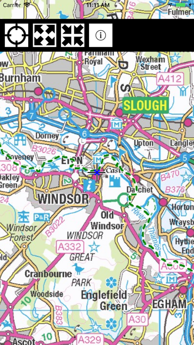
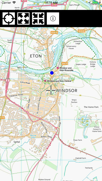
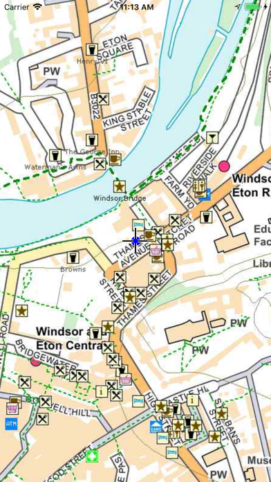
1. The area within 4km of the path is shown in detail overlaid with OSM data including street names, footpaths, pubs, restaurants, hotels, shops, toilets, ATMs, Post Offices, locks, pharmacies, and points of interest.
2. The detailed maps are overlaid with a 1km grid and OS 10m contours and with the very latest Open Streetmap (OSM) data, making it an invaluable walking companion.
3. Other footpaths (not necessarily public rights of way) are shown in narrow green dashed lines.
4. Your own location is shown and the Thames Path is highlighted in thick green dashed lines.
5. The map contains Ordnance Survey data ©Crown copyright and database right 2018 and vector data ©OpenStreetMap contributors.
6. The region outside the 4km is shown in less detail but can still be used as an offline map of the entire Thames Valley.
7. Once loaded, the entire map is held on your device and requires no further access to the Internet – it even works in Airplane mode.
8. Tap the map once to toggle the function keys on/off.
9. Many of these are labelled.
10. Liked Thames Path Map Lite? here are 5 Navigation apps like Trucker Path: Truck GPS & Maps; Droppath Route Planner & Map; Footpath Route Planner; PathAway Outdoor Navigation; Share My Path;
Or follow the guide below to use on PC:
Select Windows version:
Install Thames Path Map Lite app on your Windows in 4 steps below:
Download a Compatible APK for PC
| Download | Developer | Rating | Current version |
|---|---|---|---|
| Get APK for PC → | Paul Johnson | 5.00 | 1.1 |
Get Thames Path Map Lite on Apple macOS
| Download | Developer | Reviews | Rating |
|---|---|---|---|
| Get $4.99 on Mac | Paul Johnson | 1 | 5.00 |
Download on Android: Download Android
 PC Apps